


Pez
@pezexweather.bsky.social
Skywarn for PBZ || Amateur Storm Chaser || Like NASCAR, Football, and Baseball || Love Storm Chasing ||
Youtube: https://www.youtube.com/@PezexWeather
Youtube: https://www.youtube.com/@PezexWeather
Pinned
Pez
@pezexweather.bsky.social
· Nov 21

WX Pez
www.youtube.com
I have a YouTube channel for anyone interested! I will be posting most of my storm/extreme weather videos over there.
www.youtube.com/@PezexWeather
#wxsky #skywx
www.youtube.com/@PezexWeather
#wxsky #skywx
Reposted by Pez

Two more NWS Upper Air Sites have suspended upper air launches - Omaha and Rapid City.
Here are two maps that show the degradation of our upper air network because of helium or staff shortages (or in the case of Chatham, because of coastal erosion).
www.weather.gov/media/notifi...
Here are two maps that show the degradation of our upper air network because of helium or staff shortages (or in the case of Chatham, because of coastal erosion).
www.weather.gov/media/notifi...


March 20, 2025 at 8:26 PM
Two more NWS Upper Air Sites have suspended upper air launches - Omaha and Rapid City.
Here are two maps that show the degradation of our upper air network because of helium or staff shortages (or in the case of Chatham, because of coastal erosion).
www.weather.gov/media/notifi...
Here are two maps that show the degradation of our upper air network because of helium or staff shortages (or in the case of Chatham, because of coastal erosion).
www.weather.gov/media/notifi...
Reposted by Pez

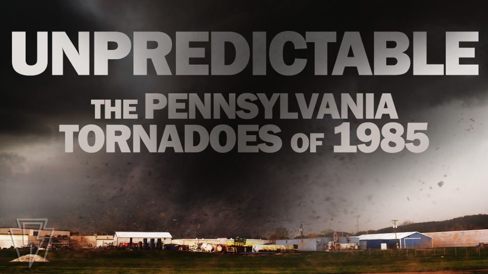
UNPREDICTABLE: The Pennsylvania Tornadoes of May 31, 1985 is live on YouTube! A cinematic, originally-crafted, immersive look into an unexpected and notorious day in local history that I've been fascinated with and personally connected to my whole life. www.youtube.com/watch?v=m47Q...
March 7, 2025 at 10:42 PM
UNPREDICTABLE: The Pennsylvania Tornadoes of May 31, 1985 is live on YouTube! A cinematic, originally-crafted, immersive look into an unexpected and notorious day in local history that I've been fascinated with and personally connected to my whole life. www.youtube.com/watch?v=m47Q...
Reposted by Pez
NWS offices across the country seem to be letting college students know that the summer volunteer program is being shuttered.

March 4, 2025 at 7:17 PM
NWS offices across the country seem to be letting college students know that the summer volunteer program is being shuttered.


Reposted by Pez
Pine Ridge Airport in SW South Dakota hit 62 on Monday for a temperature rise of 95 degrees since it was minus-33 on Feb. 19.
And it wasn't even the big weather story of the day for the state. #spring
And it wasn't even the big weather story of the day for the state. #spring

South Dakota's earliest tornado as fake spring flexes its muscles
Warmth rules the Lower 48, for now.
www.weatherretort.com
February 25, 2025 at 2:26 PM
Pine Ridge Airport in SW South Dakota hit 62 on Monday for a temperature rise of 95 degrees since it was minus-33 on Feb. 19.
And it wasn't even the big weather story of the day for the state. #spring
And it wasn't even the big weather story of the day for the state. #spring
Reposted by Pez
I have a YouTube channel for anyone interested! I will be posting most of my storm/extreme weather videos over there.
www.youtube.com/@PezexWeather
#wxsky #skywx
www.youtube.com/@PezexWeather
#wxsky #skywx
WX Pez
www.youtube.com
November 21, 2024 at 4:18 PM
I have a YouTube channel for anyone interested! I will be posting most of my storm/extreme weather videos over there.
www.youtube.com/@PezexWeather
#wxsky #skywx
www.youtube.com/@PezexWeather
#wxsky #skywx
Reposted by Pez
This week's Weather Rewind dealt with a pretty crippling blizzard on January 26, 1996. It was part of a multi-week stretch that involved multiple winter storms and all-time record cold: www.kcrg.com/video/2025/0...

First Alert: Weather Now - Weather Rewind for Monday, January 20
A blizzard struck Iowa late in January 1996, snarling traffic and leaving heavy snow behind. KCRG-TV9's Mike Wagner reports on the aftermath at the time.
www.kcrg.com
January 25, 2025 at 2:17 AM
This week's Weather Rewind dealt with a pretty crippling blizzard on January 26, 1996. It was part of a multi-week stretch that involved multiple winter storms and all-time record cold: www.kcrg.com/video/2025/0...
Reposted by Pez


Reposted by Pez

Reposted by Pez
The remainder of the Winter Storm Watch has been upgraded to a Winter Storm Warning. A Winter Weather Advisory also issued just to the north of the warning. Images below contain more details on the upcoming winter weather. Latest at http://weather.gov/pbz.


January 5, 2025 at 10:02 AM
The remainder of the Winter Storm Watch has been upgraded to a Winter Storm Warning. A Winter Weather Advisory also issued just to the north of the warning. Images below contain more details on the upcoming winter weather. Latest at http://weather.gov/pbz.
Reposted by Pez

It’s the end of an era today, as SPC lead forecaster Roger Edwards retires after more than 3 decades of service. I’ve spent 15 years, most of my career and more than a third of my life, working with Roger. He’s been a friend, mentor, and family. His contributions to the science are many and lasting.


December 31, 2024 at 3:50 PM
It’s the end of an era today, as SPC lead forecaster Roger Edwards retires after more than 3 decades of service. I’ve spent 15 years, most of my career and more than a third of my life, working with Roger. He’s been a friend, mentor, and family. His contributions to the science are many and lasting.
Strong long-track tornadoes are possible today mainly southeast Texas. Be on high alert today especially in the yellow shaded area!
🟢= 2-5% for a tornado
🟤 = 5-9% for a tornado
🟡 = 10-14% for a STRONG tornado (EF2+ possible)
🟢= 2-5% for a tornado
🟤 = 5-9% for a tornado
🟡 = 10-14% for a STRONG tornado (EF2+ possible)

December 26, 2024 at 4:24 PM
Strong long-track tornadoes are possible today mainly southeast Texas. Be on high alert today especially in the yellow shaded area!
🟢= 2-5% for a tornado
🟤 = 5-9% for a tornado
🟡 = 10-14% for a STRONG tornado (EF2+ possible)
🟢= 2-5% for a tornado
🟤 = 5-9% for a tornado
🟡 = 10-14% for a STRONG tornado (EF2+ possible)
Reposted by Pez
Snow band starting to set up...no reports yet but here's a look at several cams. Looking like a quick inch with visibility dropping down to approximately a mile. Have not seen any lower than that yet.

December 21, 2024 at 1:41 PM
Snow band starting to set up...no reports yet but here's a look at several cams. Looking like a quick inch with visibility dropping down to approximately a mile. Have not seen any lower than that yet.
Reposted by Pez

Light #snow in Downtown #Pittsburgh from this same line. Looks like the #snowsquall will be just east of me (I'm where the red dot is in this picture).
#pawx #wxbluesky #wx ❄️
#pawx #wxbluesky #wx ❄️

December 21, 2024 at 1:56 PM
Light #snow in Downtown #Pittsburgh from this same line. Looks like the #snowsquall will be just east of me (I'm where the red dot is in this picture).
#pawx #wxbluesky #wx ❄️
#pawx #wxbluesky #wx ❄️
Reposted by Pez
December 16th, 2011:
Large Kelvin-Helmholtz waves were seen near Birmingham, Alabama.
www.alabamawx.com?p=55225&fbcl...
@spann.bsky.social
Large Kelvin-Helmholtz waves were seen near Birmingham, Alabama.
www.alabamawx.com?p=55225&fbcl...
@spann.bsky.social


December 16, 2024 at 4:13 PM
December 16th, 2011:
Large Kelvin-Helmholtz waves were seen near Birmingham, Alabama.
www.alabamawx.com?p=55225&fbcl...
@spann.bsky.social
Large Kelvin-Helmholtz waves were seen near Birmingham, Alabama.
www.alabamawx.com?p=55225&fbcl...
@spann.bsky.social
Reposted by Pez
Rain is on its way and will likely be fairly consistent through the afternoon and evening hours.
Bring out that umbrella for the afternoon commute and activities while looking at the latest radar imagery at http://radar.weather.gov.
Bring out that umbrella for the afternoon commute and activities while looking at the latest radar imagery at http://radar.weather.gov.

December 16, 2024 at 4:36 PM
Rain is on its way and will likely be fairly consistent through the afternoon and evening hours.
Bring out that umbrella for the afternoon commute and activities while looking at the latest radar imagery at http://radar.weather.gov.
Bring out that umbrella for the afternoon commute and activities while looking at the latest radar imagery at http://radar.weather.gov.

Reposted by Pez

Based on remarkable footage of the damaging #ScottsValley, CA (Santa Criz County) tornado today, it's likely be this was at least an EF-1, possibly EF-2. NWS Bay Area will formally assess damage and make a determination. I'll discuss on livestream Sun or Mon. #CAwx

Wow. Flipped over quite a few vehicles, including a calfire pick up truck, pushed over a few utility poles. #CAwx #ScottsValleytornado
December 15, 2024 at 2:48 AM
Based on remarkable footage of the damaging #ScottsValley, CA (Santa Criz County) tornado today, it's likely be this was at least an EF-1, possibly EF-2. NWS Bay Area will formally assess damage and make a determination. I'll discuss on livestream Sun or Mon. #CAwx
Reposted by Pez
Current conditions show many areas west of the PA border and southwest of Pittsburgh at or above 32°F. Eastern Forest County and areas along the Appalachian ridges have a high probability of remaining below 32°F today which is where the highest likelihood for accumulating ice.

December 15, 2024 at 2:16 PM
Current conditions show many areas west of the PA border and southwest of Pittsburgh at or above 32°F. Eastern Forest County and areas along the Appalachian ridges have a high probability of remaining below 32°F today which is where the highest likelihood for accumulating ice.
Reposted by Pez

From NWS Tulsa - The Winter Weather Awareness Week topic - Winter Precip Types. We get all of them and it's not just the surface conditions that determine them. Reporting real-time precip types via mPING, social media or a simple phone call helps our ops! #okwx #arwx #WWAW2024


December 13, 2024 at 7:58 PM
Reposted by Pez

Are you aware of any #tornado shelters that are missing from the map at findyourtornadoshelter.com?
Forward them upwards to me, and I will take a look and update the map as needed. I want it to be as complete as possible.
Forward them upwards to me, and I will take a look and update the map as needed. I want it to be as complete as possible.

December 10, 2024 at 8:52 PM
Are you aware of any #tornado shelters that are missing from the map at findyourtornadoshelter.com?
Forward them upwards to me, and I will take a look and update the map as needed. I want it to be as complete as possible.
Forward them upwards to me, and I will take a look and update the map as needed. I want it to be as complete as possible.
Hello BlueSky, how is everyone doing?
December 7, 2024 at 4:28 PM
Hello BlueSky, how is everyone doing?
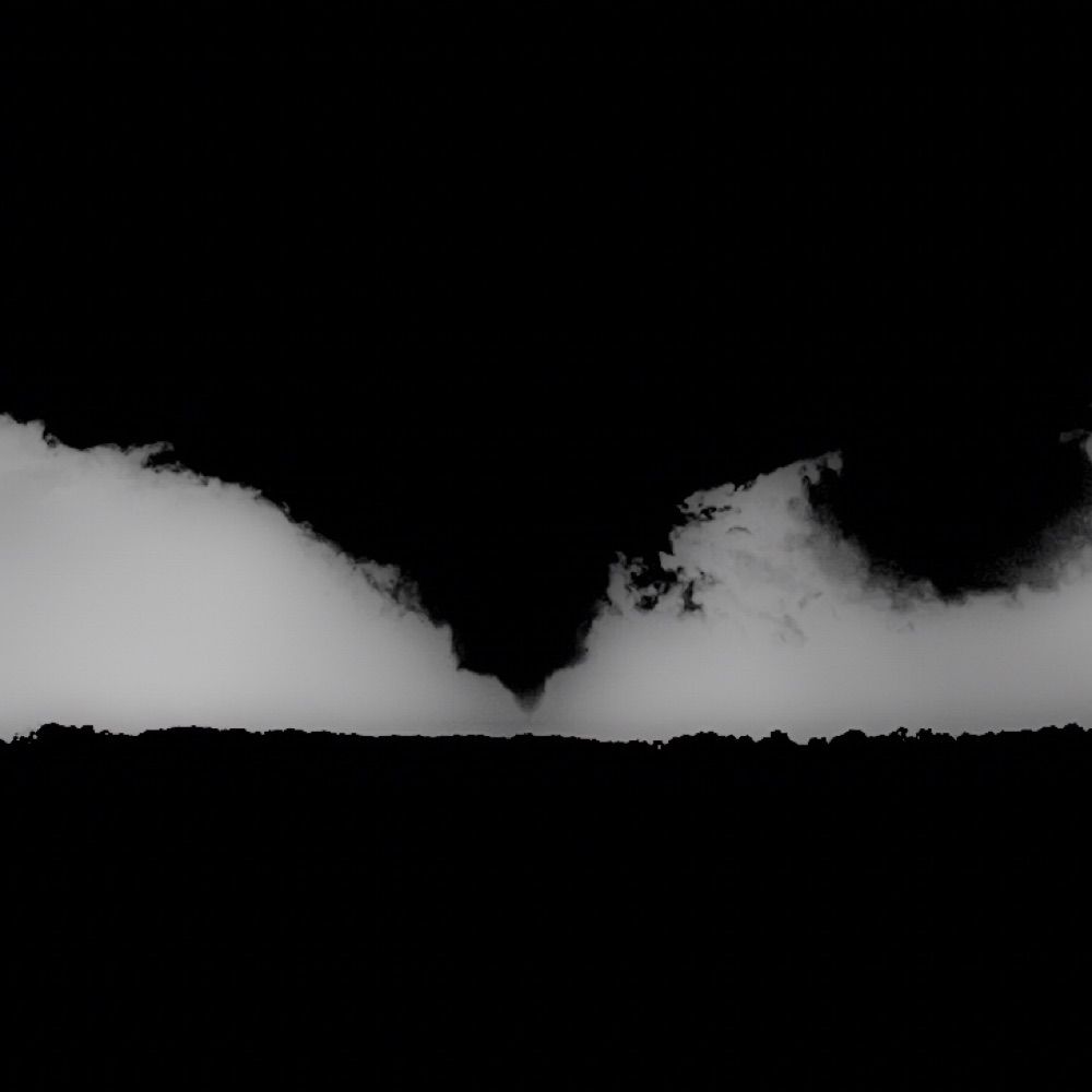
Going back in the past and an interesting tornado path caught my eye as it road the river. Very interesting to see for sure. My guess is the tornado is following the path of least resistance.
EF1 tornado from 8/25/23 in southwest Pennsylvania
#wxsky
EF1 tornado from 8/25/23 in southwest Pennsylvania
#wxsky

December 7, 2024 at 1:13 AM
Going back in the past and an interesting tornado path caught my eye as it road the river. Very interesting to see for sure. My guess is the tornado is following the path of least resistance.
EF1 tornado from 8/25/23 in southwest Pennsylvania
#wxsky
EF1 tornado from 8/25/23 in southwest Pennsylvania
#wxsky