
Robbi Bishop-Taylor 🛰️🌏
@satellitesci.bsky.social
6K followers
2.8K following
1.3K posts
Coastal Earth Observation Scientist from Canberra, Australia. Using satellite remote sensing 🛰️, open-source geospatial 🔓🗺️, Python + R 🧑💻 and dataviz 🎨 to map the earth through space + time... 🌏
Posts
Media
Videos
Starter Packs
Pinned


Reposted by Robbi Bishop-Taylor 🛰️🌏

Reposted by Robbi Bishop-Taylor 🛰️🌏

Reposted by Robbi Bishop-Taylor 🛰️🌏

Reposted by Robbi Bishop-Taylor 🛰️🌏

Reposted by Robbi Bishop-Taylor 🛰️🌏


Reposted by Robbi Bishop-Taylor 🛰️🌏


Reposted by Robbi Bishop-Taylor 🛰️🌏

Alastair
@ajgwords.bsky.social
· Aug 2

Reposted by Robbi Bishop-Taylor 🛰️🌏

Reposted by Robbi Bishop-Taylor 🛰️🌏


Reposted by Robbi Bishop-Taylor 🛰️🌏
Reposted by Robbi Bishop-Taylor 🛰️🌏

Reposted by Robbi Bishop-Taylor 🛰️🌏
Al Merose (he/him)
@al.merose.com
· Jun 28

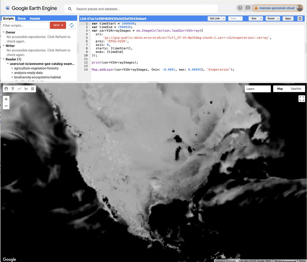
Video Compression for Spatiotemporal Earth System Data
Large-scale Earth system datasets, from high-resolution remote sensing imagery to spatiotemporal climate model outputs, exhibit characteristics analogous to those of standard videos. Their inherent sp...
arxiv.org

Reposted by Robbi Bishop-Taylor 🛰️🌏


Reposted by Robbi Bishop-Taylor 🛰️🌏


Reposted by Robbi Bishop-Taylor 🛰️🌏

Reposted by Robbi Bishop-Taylor 🛰️🌏

Mike Wulder
@mikewulder.bsky.social
· Jun 11

Landsat Next | Landsat Science
The Landsat Next project is currently assessing alternate mission architectures to support more affordable ways to maintain the continuity of Landsat imagery per the language in the FY26 President’s B...
landsat.gsfc.nasa.gov
Reposted by Robbi Bishop-Taylor 🛰️🌏