


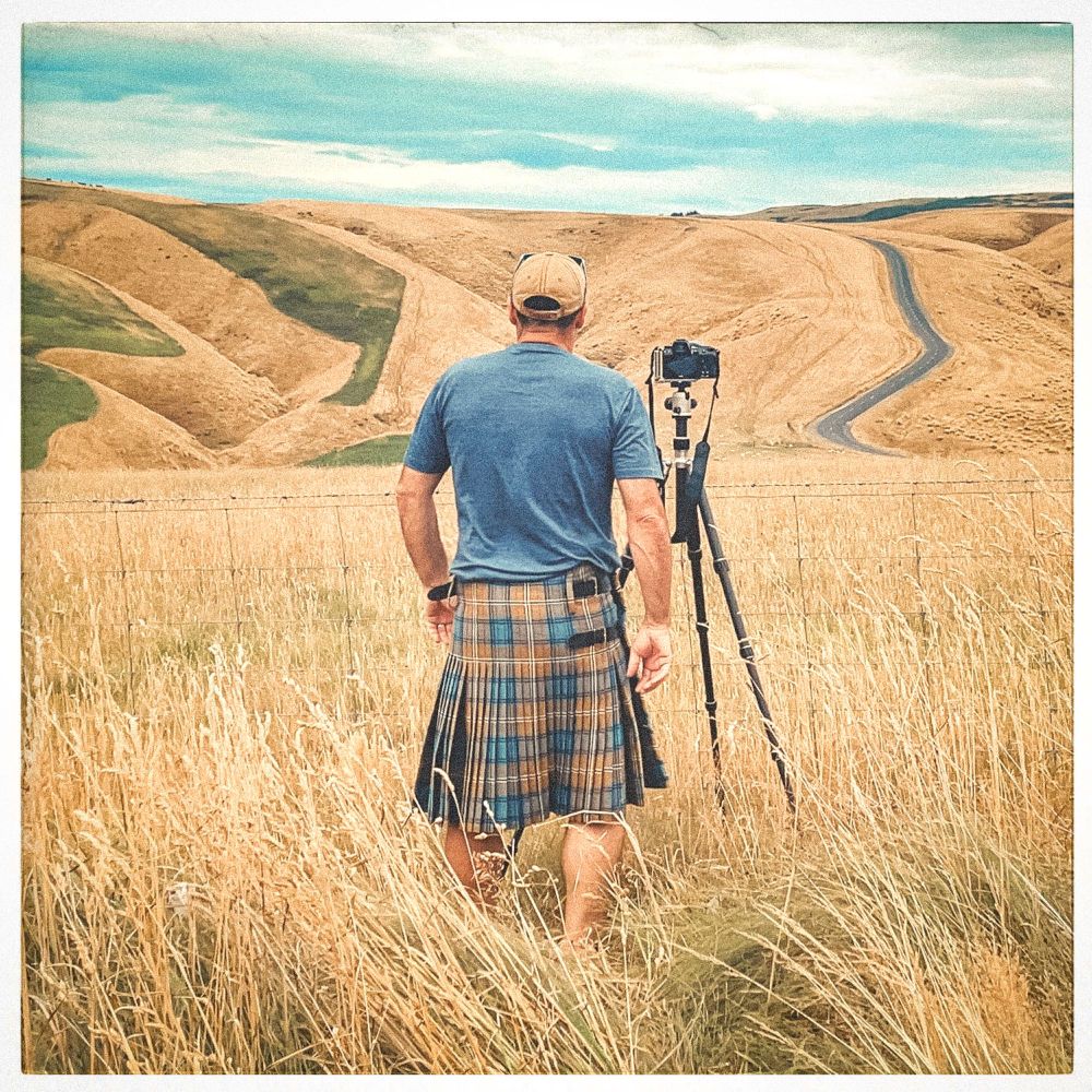
🗺️ Revisiting a post today about bringing 100k U.S. Geological Survey (USGS) Historical Topo maps into gee-community-catalog.org.🌎 I get to post this while visiting USGS HQ, the home of where many of these maps.
#RemoteSensing #OpenData #USGS #TopoMaps #HistoricalMaps #EarthEngine #DataScience
#RemoteSensing #OpenData #USGS #TopoMaps #HistoricalMaps #EarthEngine #DataScience

Paper Trails to Pixels: Historical USGS Topo Maps in Google Earth Engine Community Catalog
This week deep dive and revisit with me USGS Historical Topo maps from 1900s-2006 across the US. How I added over 100,000+ georeferenced topo maps and how you can bring them to your use case.
datacommons.substack.com
March 12, 2024 at 6:51 PM
Everybody can reply
1 likes

Scotland Ordance Survey has this lush web service,
Topomaps 1:63K 1857 - 1891 mapseries-tilesets.s3.amazonaws.com/os/one-inch-...
Topomaps 1:63K 1857 - 1891 mapseries-tilesets.s3.amazonaws.com/os/one-inch-...
one-inch-first-bart38-new
mapseries-tilesets.s3.amazonaws.com
January 19, 2025 at 7:41 PM
Everybody can reply

I never knew that Quebec/New Foundland and Labrador were so beautiful. I want to go to Lac Agramonte http://www.canmaps.com/topomaps/nts50/toporama/orthoimages/023e12.jpg (large)
December 13, 2024 at 11:58 PM
Everybody can reply

Huh. That’s nothing like the SAR training I did in Virginia — we always had our phones… I mean we trained in a lot of places with no coverage, but we often talked about useful tools like offline topomaps for phones.
Can’t count that the phone will work for wilderness SAR so don’t be reliant, though
Can’t count that the phone will work for wilderness SAR so don’t be reliant, though
August 6, 2025 at 4:39 PM
Everybody can reply
2 likes
👀
As a photographer here in the South Ngai Tahu's cultural map is, alongside TopoMaps, the most valuable tool I use.
I am at pains to use the correct name for everything now.
I mean I didn't know it was Lake Takapo, but I love that.
kahurumanu.co.nz/atlas
As a photographer here in the South Ngai Tahu's cultural map is, alongside TopoMaps, the most valuable tool I use.
I am at pains to use the correct name for everything now.
I mean I didn't know it was Lake Takapo, but I love that.
kahurumanu.co.nz/atlas

Atlas
kahurumanu.co.nz
November 14, 2024 at 8:44 PM
Everybody can reply
2 reposts
14 likes

It could be the end of Eglinton Ave with the wood bridge (W) that goes over the west branch in this 1909 topographical map.
ocul.on.ca/topomaps/col...
ocul.on.ca/topomaps/col...

October 27, 2025 at 12:40 PM
Everybody can reply
2 likes

Yup. That's probably it. I'm trying to get my new student up to speed on our American Viticultural Areas Digitizing Project that requires topomaps, so it makes sense that it went down.
January 24, 2025 at 11:09 PM
Everybody can reply
1 likes

Logically speaking, what you say makes sense. But the details of topomaps and contour lines are quite unstable, so I would personally be inclined to dismiss that subtle difference as noise. What would you say, @olaf.dimigen.de?
November 29, 2024 at 2:10 PM
Everybody can reply
#USGS Releases New #Topographic #Maps For #PuertoRico & The #USVirginIslands
-
www.usgs.gov/programs/nat...
-
#GIS #spatial #mapping #cartography #PuertoRico #USVI #USVirginIslands #topomaps #20K #UStopomaps #topographic #map #NationalMap #TheNationalMap #TNM #NationalMapCorp #volunteers
@USGS
-
www.usgs.gov/programs/nat...
-
#GIS #spatial #mapping #cartography #PuertoRico #USVI #USVirginIslands #topomaps #20K #UStopomaps #topographic #map #NationalMap #TheNationalMap #TNM #NationalMapCorp #volunteers
@USGS


November 6, 2024 at 11:48 PM
Everybody can reply
2 likes

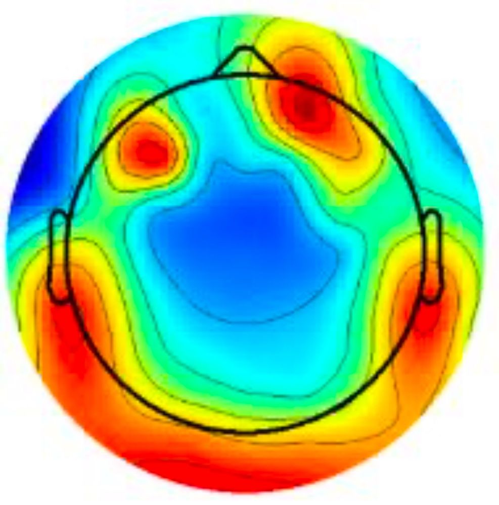
Biggest change was plotting topomaps when channels are spatially overlapping (3 channels per sensor). Now MNE just plots the most radial channel in each OPM sensor.
Most of the other stuff came from handling mag-only arrays in MNE pipeline, or ignoring calibration files for SSS.
Most of the other stuff came from handling mag-only arrays in MNE pipeline, or ignoring calibration files for SSS.
May 8, 2025 at 11:40 AM
Everybody can reply
1 likes


USGS has launched a new line of recreational topo maps—just in time for fall hikes in The Natural State. 🍁
Packed with trails, campsites, and more, explore responsibly and confidently.
arkansasoutside.com/explore-arka...
#ArkansasOutside #ExploreResponsibly #TopoMaps #HikingArkansas
Packed with trails, campsites, and more, explore responsibly and confidently.
arkansasoutside.com/explore-arka...
#ArkansasOutside #ExploreResponsibly #TopoMaps #HikingArkansas

Explore Arkansas This Fall With New USGS Recreational Topo Maps
Plan your fall hikes with new USGS Recreational Topo Maps—designed for hikers, backpackers, and outdoor explorers in Arkansas and across the U.S.
arkansasoutside.com
August 1, 2025 at 2:53 PM
Everybody can reply


You can explore the full 1:63k series in the GeoPortal here: bit.ly/41fjDdV
To learn more about the Historical Topographic Maps Digitization Project, visit the project website here: ocul.on.ca/topomaps/
#GISDay2024
To learn more about the Historical Topographic Maps Digitization Project, visit the project website here: ocul.on.ca/topomaps/
#GISDay2024

a kermit the frog is holding a piece of paper in his hand
Alt: Kermit the Frog looking at a map.
media.tenor.com
November 20, 2024 at 8:02 PM
Everybody can reply