Streetcrafting
@streetcrafting.bsky.social
600 followers 200 following 210 posts
Working to craft vibrant, safe, and resilient places for all. Living everyday by foot, bike, rail, and transit. #VisionZero #StreetsForPeople
Posts Media Videos Starter Packs
Pinned
streetcrafting.bsky.social
Thank you @nickdeshais.bsky.social and @seattletimes.com for covering last week’s events at Pine & 4th.

SDOT has taken a big step in the right direction. I hope they can learn from this.
streetcrafting.bsky.social
@seattledot.bsky.social I love seeing the planned traffic calming and safety improvements planned at E Pike & Harvard! 🙏

While you are at it, can you add physical daylighting the the NW corner as well? This is a frequent spot for illegal parking and creates a visibility hazard.
streetcrafting.bsky.social
Is SDOT’s 24 Response Team the same team as their 24 Dispatch?

It’s taken Dispatch weeks to fix the Toronto barriers at Pine & 4th, multiple times.

Even with calls everyday to remind them.

I genuinely don’t know how they prioritize things.
streetcrafting.bsky.social
I’m always interested in learning how to make great cites. Thanks!
streetcrafting.bsky.social
For clarity, this was a curiosity about the people who planted these trees generations ago. Not today’s planners.
streetcrafting.bsky.social
Is this just another example of bad planning?

Did they not know what we know know about urban forestry? Were they just arrogant?
streetcrafting.bsky.social
I consider project renders showing what trees will look like in 20 years to be professional malpractice.

I’d prefer they be honest and show us renders with saplings on the day construction is finished.

Luckily EBC seems to be planting bigger trees than average. So we may not have to wait 20 years.
streetcrafting.bsky.social
Thanks for this, very informative! I understand why, I just hope they plant trees taller than I am.
streetcrafting.bsky.social
Anyone know why @seattledot.bsky.social is planning on removing dozens of mature street trees along Alaskan Way as part of the Elliot Bay Connections Project?

Even if replacing them 3 to 1 with younger trees it’s a tragedy, when we have to wait a couple generations to regain what we already have.
streetcrafting.bsky.social
Looks similar to this one on August 29th. Same location? Incomplete repair? Separate incident?

bsky.app/profile/pwal...
pwalchtaylor.bsky.social
I was going to post about how amazing it was that I can now ride from Beacon Hill to South Park to Georgetown to downtown almost entirely in PBLs. But instead I’ll post this picture of a guy who smashed into the bike lane seconds after I rolled through:
Reposted by Streetcrafting
intcreator.com
this bike lane has been blocked for two weeks. it has been reported many times by many people by the Find It Fix It app and by phone. I bet if it was a car lane @seattledot.bsky.social would have fixed it by now
the two way bike lane on Airport Way between S Edmunds St. and S Lucile St. with two 1673 lb concrete blocks blocking one of the lanes
streetcrafting.bsky.social
There’s a lot of great stuff in this video about protected intersections.

Seattle needs intersections that are designed to prioritize safe pedestrian and bike crossings, and I hope @seattledot.bsky.social will take notes.
streetcrafting.bsky.social
👀
typewriteralley.bsky.social
Fun fact, this street is so wide because the 14 streetcar used to run through here
qagggy.bsky.social
On streets like Summit Avenue on Capitol Hill, we should be de-paving the curb zone to plant trees.
Reposted by Streetcrafting
jrock08.bsky.social
It's driver behavior wishcasting to put up a stop here on red sign 150 feet from the light. Either Wall St needs to be made one way eastbound or there needs to be another light prior to the tracks.
Screenshot of the stop here on red from streetview showing how far away the traffic signal is Google maps showing that the distance from the stop here on red bar and the stop light is 150 feet.
streetcrafting.bsky.social
@seattledot.bsky.social Not to mention the ridiculous amount of red light running at Alaskan Way & Wall St.

These drivers rolled through the intersection on red, cutting off the green bike phase.
streetcrafting.bsky.social
@seattledot.bsky.social I just had to wave this driver off the tracks as a train approached at Alaskan Way & Wall St.

This intersection is a disaster. Cruise ship loading is completely disorganized and causes massive safety issues.
streetcrafting.bsky.social
@seattledot.bsky.social Alaskan Way & Wall St desperately needs NTOR signs to ensure drivers are not blocking pedestrians and cutting off cyclists.

This is a predicable hazard and I’m astonished it wasn’t installed as part of the Alaskan Way Safety Project.

Please install for all of Alaskan ASAP.
streetcrafting.bsky.social
In the time I’ve been watching this morning, I’ve seen very good NTOR compliance here.

There have definitely been a few people that are used to a free right turn here that have started to turn on red, but all of them have stopped so far.

I’ve already seen several conflicts prevented. 🎉
streetcrafting.bsky.social
I’m excited to see the missing No Turn on Red sign at 12th & Madison has been installed!

Thank you @seattledot.bsky.social for listening to community feedback and treating this concern with urgency! I’m already seeing improved safety for all street users. 🙏
Reposted by Streetcrafting
oranv.com
Every time I go through LA’s 7th St/Metro Center station I think this is what an ST3 Westlake station should become. Very similar configuration.

They would have to dig 5th Ave very deep to add a 3rd basement level directly under the ‘wings’ but the super convenient transfers would be worth it.
Light rail train at side platforms above subway train at center platform in LA’s Metro Center subway station.
Reposted by Streetcrafting
fixthel8.bsky.social
Although we disagree with the conclusions from SDOT's traffic study, its traffic counts were very eye-opening:
• Over 3 times as many people use Denny Way to access areas east of I-5 than to access I-5 S
• Of the people continuing east, 35% do so in a car, 34% in a Route 8 bus, and 31% on foot
fixthel8.bsky.social
SDOT has updated their post about Denny Way bus lanes and have uploaded the full traffic study, which you can read below.

In short, it's a 516 page document that does not mention mode shift or alternate routing a single time.

seattle.gov/documents/De...
streetcrafting.bsky.social
To be clear, these lime bikes were not supposed to be in the bike box. The lack of official micromobilty parking here results in Lime employees just placing them where ever they feel like it. Often blocking the bike lane and sidewalks.
streetcrafting.bsky.social
@csgreenways.bsky.social has been working with SDOT to fix many issues with this intersection. SDOT is listening and changes are coming, but timing and details are still being worked out.
streetcrafting.bsky.social
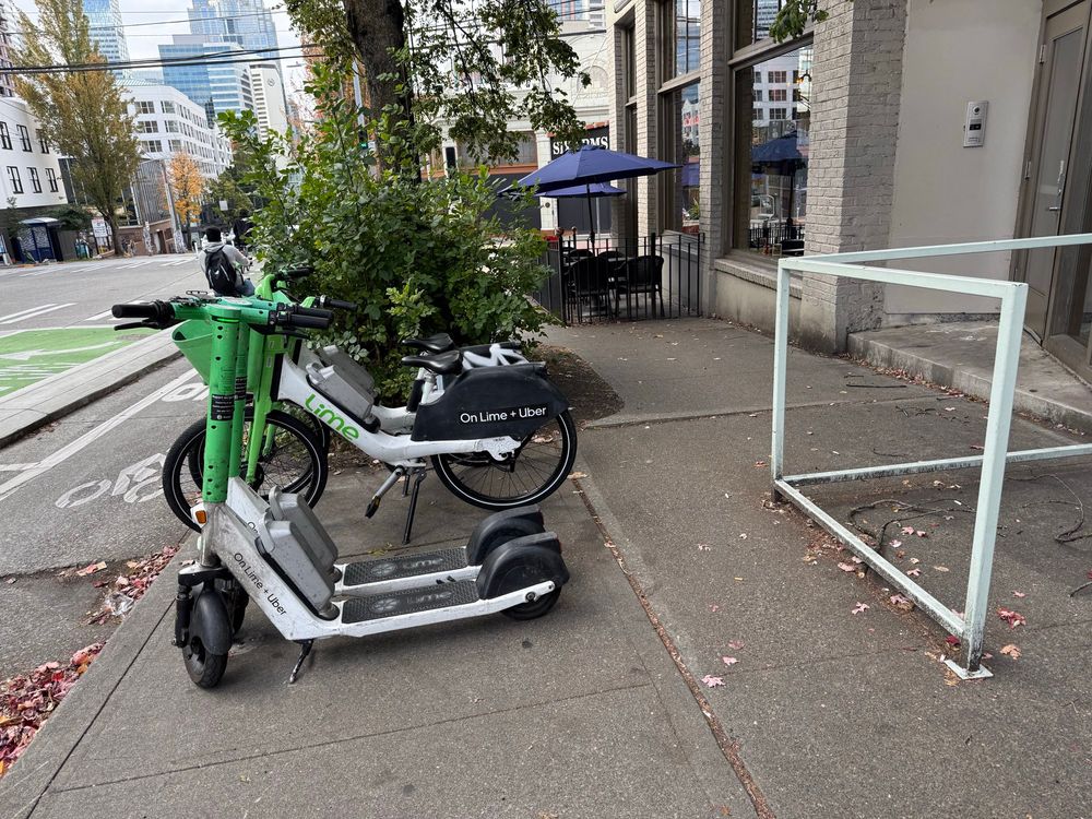
@seattledot.bsky.social lime moving their bikes/scooters from the bike lane to the constrained sidewalk does not solve the problem, it just moves it somewhere else.

Please install official micromobilty parking at E Pike & Melrose in locations that do not block people’s mobility and create hazards.