


Geomenke
@geomenke.bsky.social
Danish Resident 🇩🇰 | @SeptimaDK | FOSS4G user/advocate/educator | OsGeo Charter Member | Author: Discover QGIS 3.x 2nd Ed. | Co-author: QGIS for Hydrological Applications 2nd Ed.| Co-author: Collecting Field Data with QGIS & Mergin Maps
Reposted by Geomenke

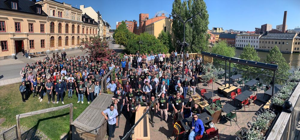
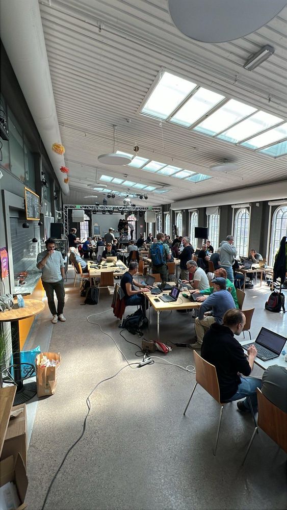
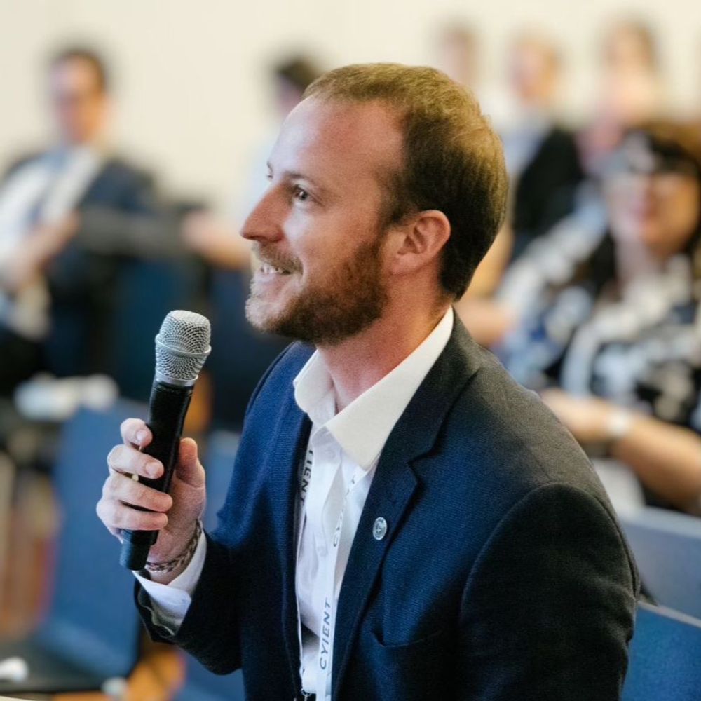
The #qgisuc2025 may be over but the contributor meeting has been going strong. Thanks to everyone who helped organize or joined as a participant!
#gischat #osgeo #qgis #opensource
#gischat #osgeo #qgis #opensource
June 5, 2025 at 7:02 PM
The #qgisuc2025 may be over but the contributor meeting has been going strong. Thanks to everyone who helped organize or joined as a participant!
#gischat #osgeo #qgis #opensource
#gischat #osgeo #qgis #opensource
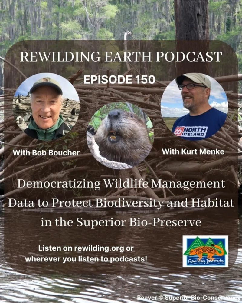
On this episode of the Rewilding Earth Podcast, Bob Boucher & I explain a new paradigm of sustainable beaver management. It involves a connectivity analysis using Omniscape plus the use of Mergin Maps & #QGIS.
This will allow beavers to serve their role as a keystone species and ecosystem engineers
This will allow beavers to serve their role as a keystone species and ecosystem engineers
June 6, 2025 at 6:34 AM
On this episode of the Rewilding Earth Podcast, Bob Boucher & I explain a new paradigm of sustainable beaver management. It involves a connectivity analysis using Omniscape plus the use of Mergin Maps & #QGIS.
This will allow beavers to serve their role as a keystone species and ecosystem engineers
This will allow beavers to serve their role as a keystone species and ecosystem engineers
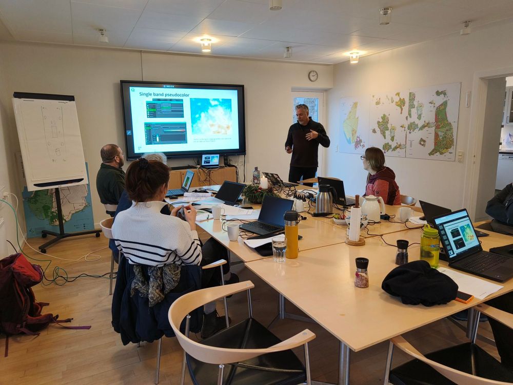
The spring Danish QGIS User Group meeting is underway in Nyborg!

May 7, 2025 at 9:29 AM
The spring Danish QGIS User Group meeting is underway in Nyborg!
Reposted by Geomenke
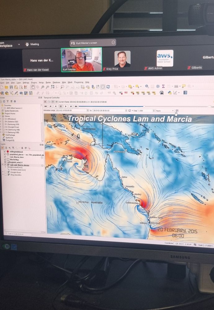
Always nice to teach a course with @geomenke.bsky.social! This was Mastering Mesh Data with #QGIS for the #AustralianWaterSchool early this morning. Soon available as on-demand online course!
March 25, 2025 at 8:40 AM
Always nice to teach a course with @geomenke.bsky.social! This was Mastering Mesh Data with #QGIS for the #AustralianWaterSchool early this morning. Soon available as on-demand online course!
Reposted by Geomenke

📚 Geocomputation with Python copies have arrived 🤩
Somehow, things feel much more real if you can touch them.
Fun fact: the cover was designed in #qgis. Speaking of going full circle ...
#gischat #python #Geopandas
Somehow, things feel much more real if you can touch them.
Fun fact: the cover was designed in #qgis. Speaking of going full circle ...
#gischat #python #Geopandas
March 6, 2025 at 2:28 PM
📚 Geocomputation with Python copies have arrived 🤩
Somehow, things feel much more real if you can touch them.
Fun fact: the cover was designed in #qgis. Speaking of going full circle ...
#gischat #python #Geopandas
Somehow, things feel much more real if you can touch them.
Fun fact: the cover was designed in #qgis. Speaking of going full circle ...
#gischat #python #Geopandas
Reposted by Geomenke
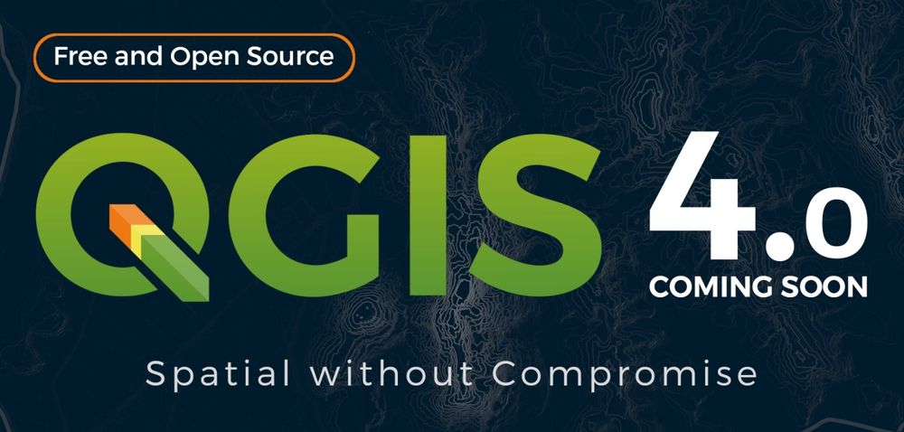
🥳 @qgis 3.42 has landed in #condaforge
https://anaconda.org/conda-forge/qgis
My favorite way to install #qgis
#conda #gischat #python #opensource
https://anaconda.org/conda-forge/qgis
My favorite way to install #qgis
#conda #gischat #python #opensource
Qgis | Anaconda.org
anaconda.org
March 14, 2025 at 9:27 PM
🥳 @qgis 3.42 has landed in #condaforge
https://anaconda.org/conda-forge/qgis
My favorite way to install #qgis
#conda #gischat #python #opensource
https://anaconda.org/conda-forge/qgis
My favorite way to install #qgis
#conda #gischat #python #opensource
I am proud that my company, Septima, just renewed their #QGIS sustaining membership. The Sustaining Membership Program is a vital funding stream for this amazing community-driven open-source project!
If you use QGIS, please consider also becoming a sustaining member: qgis.org/funding/memb...
If you use QGIS, please consider also becoming a sustaining member: qgis.org/funding/memb...

February 18, 2025 at 10:07 AM
I am proud that my company, Septima, just renewed their #QGIS sustaining membership. The Sustaining Membership Program is a vital funding stream for this amazing community-driven open-source project!
If you use QGIS, please consider also becoming a sustaining member: qgis.org/funding/memb...
If you use QGIS, please consider also becoming a sustaining member: qgis.org/funding/memb...
Reposted by Geomenke
Mastering Mesh Data with QGIS - live online course this March! Together with @geomenke.bsky.social, I'll bring you up to speed with using mesh data formats in QGIS - Register now!
awschool.com.au/training/mas... #QGIS #GIS #mesh
awschool.com.au/training/mas... #QGIS #GIS #mesh
February 17, 2025 at 7:30 AM
Mastering Mesh Data with QGIS - live online course this March! Together with @geomenke.bsky.social, I'll bring you up to speed with using mesh data formats in QGIS - Register now!
awschool.com.au/training/mas... #QGIS #GIS #mesh
awschool.com.au/training/mas... #QGIS #GIS #mesh
Reposted by Geomenke
The video recordings from #foss4g_sotm_2024 are now live!
Check it out for a bit of a glimpse at the vibe for #foss4g2025 in Auckland!
www.youtube.com/playlist?lis...
Check it out for a bit of a glimpse at the vibe for #foss4g2025 in Auckland!
www.youtube.com/playlist?lis...

FOSS4G SotM Oceania 2024 - YouTube
The FOSS4G SotM Oceania Conference 2024 was held in Hobart, Australia from the 5th - 9th of November 2024
www.youtube.com
January 24, 2025 at 1:47 AM
The video recordings from #foss4g_sotm_2024 are now live!
Check it out for a bit of a glimpse at the vibe for #foss4g2025 in Auckland!
www.youtube.com/playlist?lis...
Check it out for a bit of a glimpse at the vibe for #foss4g2025 in Auckland!
www.youtube.com/playlist?lis...
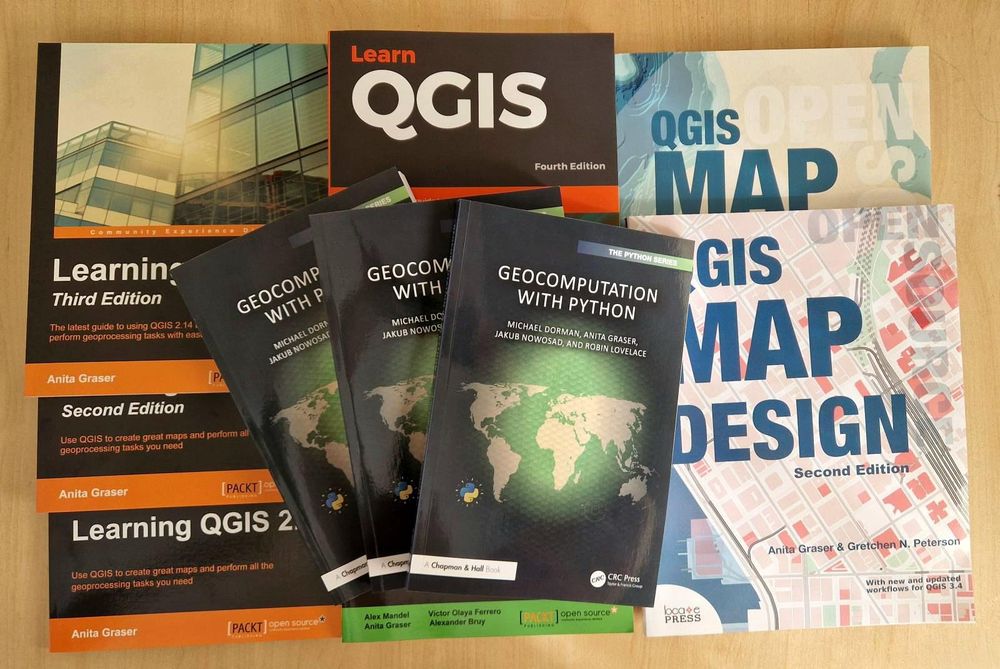
Discover QGIS 3.x is now available at Philipps-Universität Marburg 🇩🇪!
I wrote this to support teaching GIS w/ QGIS. If you plan on teaching #QGIS at your school, consider using it.
It contains 32 lab exercises w/ solution files & challenge assignments to support learning.
locatepress.com/book/dq32
I wrote this to support teaching GIS w/ QGIS. If you plan on teaching #QGIS at your school, consider using it.
It contains 32 lab exercises w/ solution files & challenge assignments to support learning.
locatepress.com/book/dq32

January 22, 2025 at 6:45 PM
Discover QGIS 3.x is now available at Philipps-Universität Marburg 🇩🇪!
I wrote this to support teaching GIS w/ QGIS. If you plan on teaching #QGIS at your school, consider using it.
It contains 32 lab exercises w/ solution files & challenge assignments to support learning.
locatepress.com/book/dq32
I wrote this to support teaching GIS w/ QGIS. If you plan on teaching #QGIS at your school, consider using it.
It contains 32 lab exercises w/ solution files & challenge assignments to support learning.
locatepress.com/book/dq32
Reposted by Geomenke

The outgoing administration has released Leonard Peltier from prison. Numerous activists and tribal officials have requested the release of Peltier, whom they believe to be innocent of killing two FBI agents in 1975. via @mprnews.org

Indigenous activist Leonard Peltier granted clemency by President Biden
The outgoing administration has released Leonard Peltier from prison. Numerous activists and tribal officials have requested the release of Peltier, whom they believe to be innocent of killing two FBI...
www.mprnews.org
January 20, 2025 at 5:59 PM
The outgoing administration has released Leonard Peltier from prison. Numerous activists and tribal officials have requested the release of Peltier, whom they believe to be innocent of killing two FBI agents in 1975. via @mprnews.org
RIP David Lynch - one of my favorite directors

January 16, 2025 at 9:23 PM
RIP David Lynch - one of my favorite directors
Reposted by Geomenke
TIL that @qgis has been recognized as a #DigitalPublicGood :blobcatcool:
https://www.digitalpublicgoods.net/r/qgis
#qgis #gischat #osgeo #opensource #gis
https://www.digitalpublicgoods.net/r/qgis
#qgis #gischat #osgeo #opensource #gis
January 9, 2025 at 5:09 PM
TIL that @qgis has been recognized as a #DigitalPublicGood :blobcatcool:
https://www.digitalpublicgoods.net/r/qgis
#qgis #gischat #osgeo #opensource #gis
https://www.digitalpublicgoods.net/r/qgis
#qgis #gischat #osgeo #opensource #gis
Reposted by Geomenke
Super excited to share this episode with everyone. Below is a teaser for my interview with Captain Paul Watson after his release from prison in Nuuk. #paulwatson
www.youtube.com/watch?v=yMjZ...
www.youtube.com/watch?v=yMjZ...

Paul Watson Interview Post Release (Teaser)
YouTube video by The Rewilding Institute
www.youtube.com
December 19, 2024 at 4:18 PM
Super excited to share this episode with everyone. Below is a teaser for my interview with Captain Paul Watson after his release from prison in Nuuk. #paulwatson
www.youtube.com/watch?v=yMjZ...
www.youtube.com/watch?v=yMjZ...
Reposted by Geomenke

Jack Humphrey talks with Paul Watson less than 2 days from being freed from prison in Nuuk, Greenland, cleared of all charges. Another black eye for illegal Japanese whaling. rewilding.org/no-surrender... #paulwatson

Episode 138: No Surrender! Paul Watson Talks About His Latest Victory Over Japan and The Battles Ahead
"It's obvious to me that Japan [was] seeking revenge for the international humiliation caused by the Whale Wars TV series, reporting our actions against illeg
rewilding.org
December 20, 2024 at 3:37 PM
Jack Humphrey talks with Paul Watson less than 2 days from being freed from prison in Nuuk, Greenland, cleared of all charges. Another black eye for illegal Japanese whaling. rewilding.org/no-surrender... #paulwatson
#30DayMapChallenge 2024 Day 13: A New Tool part 2
I just played with Pretty Maps to make a quick fall themed map of old Tallinn, Estonia
I just played with Pretty Maps to make a quick fall themed map of old Tallinn, Estonia

December 13, 2024 at 12:52 PM
#30DayMapChallenge 2024 Day 13: A New Tool part 2
I just played with Pretty Maps to make a quick fall themed map of old Tallinn, Estonia
I just played with Pretty Maps to make a quick fall themed map of old Tallinn, Estonia
#30DayMapChallenge 2024 Day 11: Arctic
A temporal animation of the circumpolar migration of Arctic Terns. They have the longest migration, seeing 2 summers each year, as they migrate along a route from northern breeding grounds in the Arctic, to the Antarctic coast for the southern summer & back.
A temporal animation of the circumpolar migration of Arctic Terns. They have the longest migration, seeing 2 summers each year, as they migrate along a route from northern breeding grounds in the Arctic, to the Antarctic coast for the southern summer & back.
December 13, 2024 at 12:51 PM
#30DayMapChallenge 2024 Day 11: Arctic
A temporal animation of the circumpolar migration of Arctic Terns. They have the longest migration, seeing 2 summers each year, as they migrate along a route from northern breeding grounds in the Arctic, to the Antarctic coast for the southern summer & back.
A temporal animation of the circumpolar migration of Arctic Terns. They have the longest migration, seeing 2 summers each year, as they migrate along a route from northern breeding grounds in the Arctic, to the Antarctic coast for the southern summer & back.
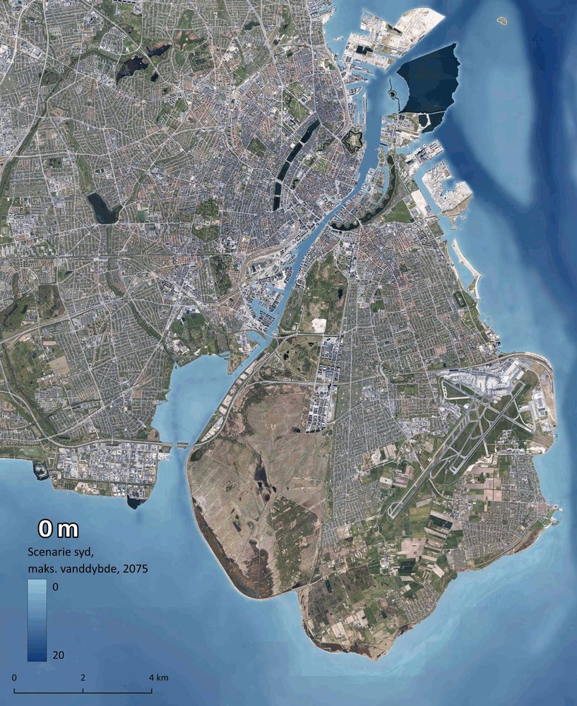
#30DayMapChallenge 2024 Day 12: Time and Space
An animation of storm induced flooding in Copenhagen from a scenario modeling potential conditions from a 1,000 year storm coming from the south in 2075. Made with #QGIS and #ffmpeg
An animation of storm induced flooding in Copenhagen from a scenario modeling potential conditions from a 1,000 year storm coming from the south in 2075. Made with #QGIS and #ffmpeg
December 13, 2024 at 12:47 PM
#30DayMapChallenge 2024 Day 12: Time and Space
An animation of storm induced flooding in Copenhagen from a scenario modeling potential conditions from a 1,000 year storm coming from the south in 2075. Made with #QGIS and #ffmpeg
An animation of storm induced flooding in Copenhagen from a scenario modeling potential conditions from a 1,000 year storm coming from the south in 2075. Made with #QGIS and #ffmpeg
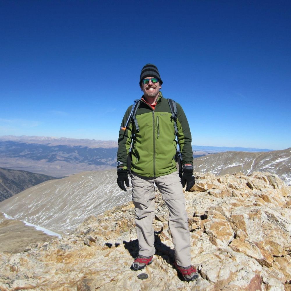
10 years ago! It was such an honor. I had a 15 year relationship with the National Library of Medicine before moving to Denmark. During this time, I developed a program named Community Health Maps (lnkd.in/eAhnHZC6) for public health officials working with under-served and at-risk communities.

December 8, 2024 at 3:14 PM
10 years ago! It was such an honor. I had a 15 year relationship with the National Library of Medicine before moving to Denmark. During this time, I developed a program named Community Health Maps (lnkd.in/eAhnHZC6) for public health officials working with under-served and at-risk communities.
#30DayMapChallenge 2024 Day 7: Vintage style
UFO sightings in Denmark. There have not been many! Data from: www.kaggle.com/datasets/NUF...
#QGIS
UFO sightings in Denmark. There have not been many! Data from: www.kaggle.com/datasets/NUF...
#QGIS

December 7, 2024 at 9:31 AM
#30DayMapChallenge 2024 Day 7: Vintage style
UFO sightings in Denmark. There have not been many! Data from: www.kaggle.com/datasets/NUF...
#QGIS
UFO sightings in Denmark. There have not been many! Data from: www.kaggle.com/datasets/NUF...
#QGIS
#30DayMapChallenge 2024 Day 6: Raster
This is an analysis for the Superior Bio-Conservancy with the goal of modeling biodiversity connectivity in the North Woods. I used Omniscape.jl to model wall-2-wall structural connectivity across the study area w/ emphasis on riparian corridors & biodiversity
This is an analysis for the Superior Bio-Conservancy with the goal of modeling biodiversity connectivity in the North Woods. I used Omniscape.jl to model wall-2-wall structural connectivity across the study area w/ emphasis on riparian corridors & biodiversity
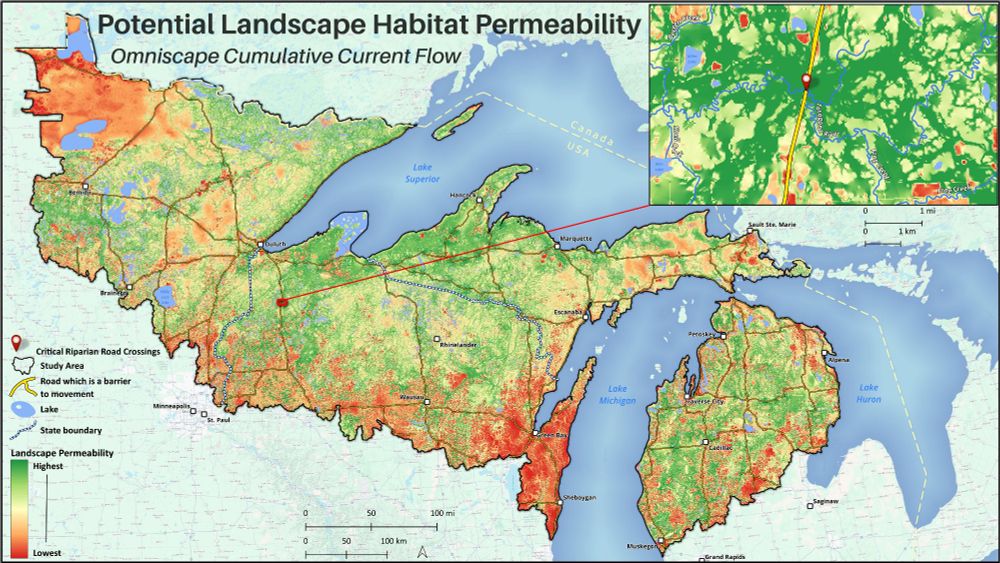
December 6, 2024 at 7:17 AM
#30DayMapChallenge 2024 Day 6: Raster
This is an analysis for the Superior Bio-Conservancy with the goal of modeling biodiversity connectivity in the North Woods. I used Omniscape.jl to model wall-2-wall structural connectivity across the study area w/ emphasis on riparian corridors & biodiversity
This is an analysis for the Superior Bio-Conservancy with the goal of modeling biodiversity connectivity in the North Woods. I used Omniscape.jl to model wall-2-wall structural connectivity across the study area w/ emphasis on riparian corridors & biodiversity
#30DayMapChallenge 2024 Day 5: A journey
Here is an animation of my 500 mi / 800 km hike across Oregon in 1994. 38 days sleeping in a tent - swam in 36 lakes - climbed 7 peaks - one of the best outdoor adventures I've had! Made via the QGIS Atlas.
#QGIS #PCT #Oregon
Here is an animation of my 500 mi / 800 km hike across Oregon in 1994. 38 days sleeping in a tent - swam in 36 lakes - climbed 7 peaks - one of the best outdoor adventures I've had! Made via the QGIS Atlas.
#QGIS #PCT #Oregon

December 5, 2024 at 9:34 AM
#30DayMapChallenge 2024 Day 5: A journey
Here is an animation of my 500 mi / 800 km hike across Oregon in 1994. 38 days sleeping in a tent - swam in 36 lakes - climbed 7 peaks - one of the best outdoor adventures I've had! Made via the QGIS Atlas.
#QGIS #PCT #Oregon
Here is an animation of my 500 mi / 800 km hike across Oregon in 1994. 38 days sleeping in a tent - swam in 36 lakes - climbed 7 peaks - one of the best outdoor adventures I've had! Made via the QGIS Atlas.
#QGIS #PCT #Oregon
#30DayMapChallenge 2024 Day 4: Hexagons
Archaeological site density in Denmark by hexagon within a hexagon 😉 .
#QGIS #archaeology #hexagon
Archaeological site density in Denmark by hexagon within a hexagon 😉 .
#QGIS #archaeology #hexagon

December 4, 2024 at 9:12 AM
#30DayMapChallenge 2024 Day 4: Hexagons
Archaeological site density in Denmark by hexagon within a hexagon 😉 .
#QGIS #archaeology #hexagon
Archaeological site density in Denmark by hexagon within a hexagon 😉 .
#QGIS #archaeology #hexagon