


Meteorologist, Storm Chaser, Journalist & Photographer: Hurricanes, Tornadoes, & Winter Storms
www.stormgasm.com


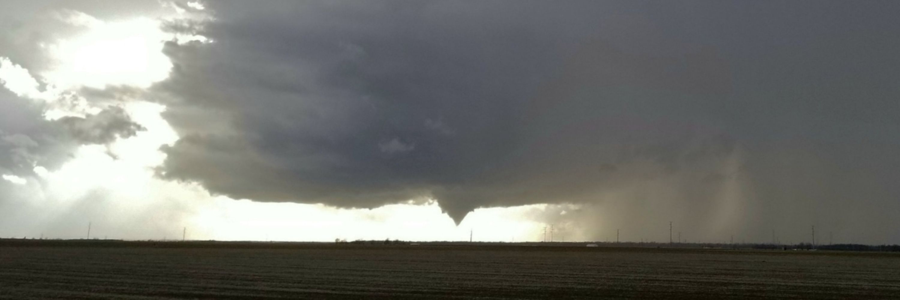
OTD 17 years ago, February 10, 2009, Juston Drake and I documented tornadic supercells and baseball-sized hail over Oklahoma. Got a glimpse of a funnel before it became rain-wrapped over the OKC Metro. #OKwx


grateful to have been able to document this local historic event in my hometown. Understand this was nothing on the scale of the Great Blizzard of '78 with respect to overall storm intensity. #OHwx
12.4 inches of snow accumulation at the Dayton International Airport. This overtakes the official 12.2 inches measured from the infamous Blizzard of 1978, also known as the Midwest Super Bomb.


#KYwx

Reposted by Simon Brewer

Reposted by Simon Brewer


Snow began falling in Seattle, Washington, and would continue for much of the week. When it was over, more than 5 feet of snow was recorded.


youtu.be/HKp5A9j06fo?...

10 years ago yesterday, December 23, 2015, @JustonStrmRider and I documented a longtrack, violent tornado pass northwest of Batesville, Mississippi, during a significant outbreak. People were at a Christmas festival in town as this beast passed. #mswx
Reposted by Simon Brewer


A widespread severe weather event impacted numerous states, from Texas to Pennsylvania. The SPC received over 300 wind reports, several of which were >65 kts. Fifteen tornadoes were confirmed, 3 of which were rated EF2. Four people were killed.


OTD 15 years ago, December 21, 2010, I pulled over on HWY 77 near Wynnewood, Oklahoma, walked out into the tall grass, and photographed a total lunar eclipse just past midnight. Another won't occur on the winter solstice for 98 years. #WinterSolstice #okwx
Reposted by Simon Brewer


Reposted by Simon Brewer


Reposted by Simon Brewer
Tomorrow morning it will make a run at the all-time record water level #wawx
Reposted by Simon Brewer

Reposted by Simon Brewer


Reposted by Simon Brewer

Reposted by Simon Brewer


An intense tornado struck the Naval Submarine Base Kings Bay in Georgia. The large EF3 threw vehicles and trailers, downed power poles, and blew over many trees on a nearby island. A boat anemometer measured a 144 mph gust. Four people were injured.


OTD 7 years ago, December 1, 2018, I chased a small outbreak of #Twisters over Central Illinois. Captured a few cool photos as this cyclic supercell produced half a dozen twisters between Naples and Havana, IL on the 1st day of Meteorological Winter.
#ILwx

December 1, 2025 #ohwx


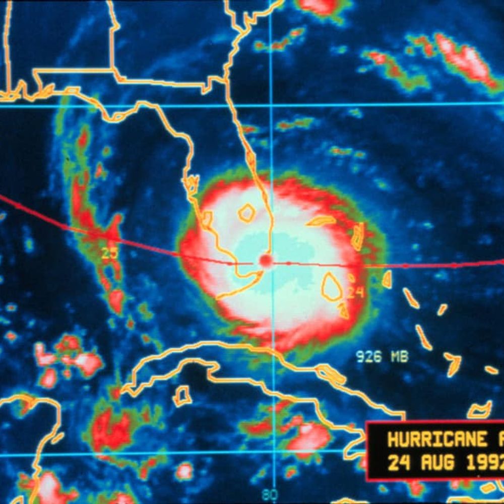
May 31, 2013 El Reno, Oklahoma
Megawedge (noun) - defined as a visually wedge-shaped tornado with respect to the observer from a wall cloud or updraft base to Earth's surface with a diameter equal to or greater than 1.5 miles in diameter.
#okwx


Still 5+ weeks to go...
with @JustonStrmRider


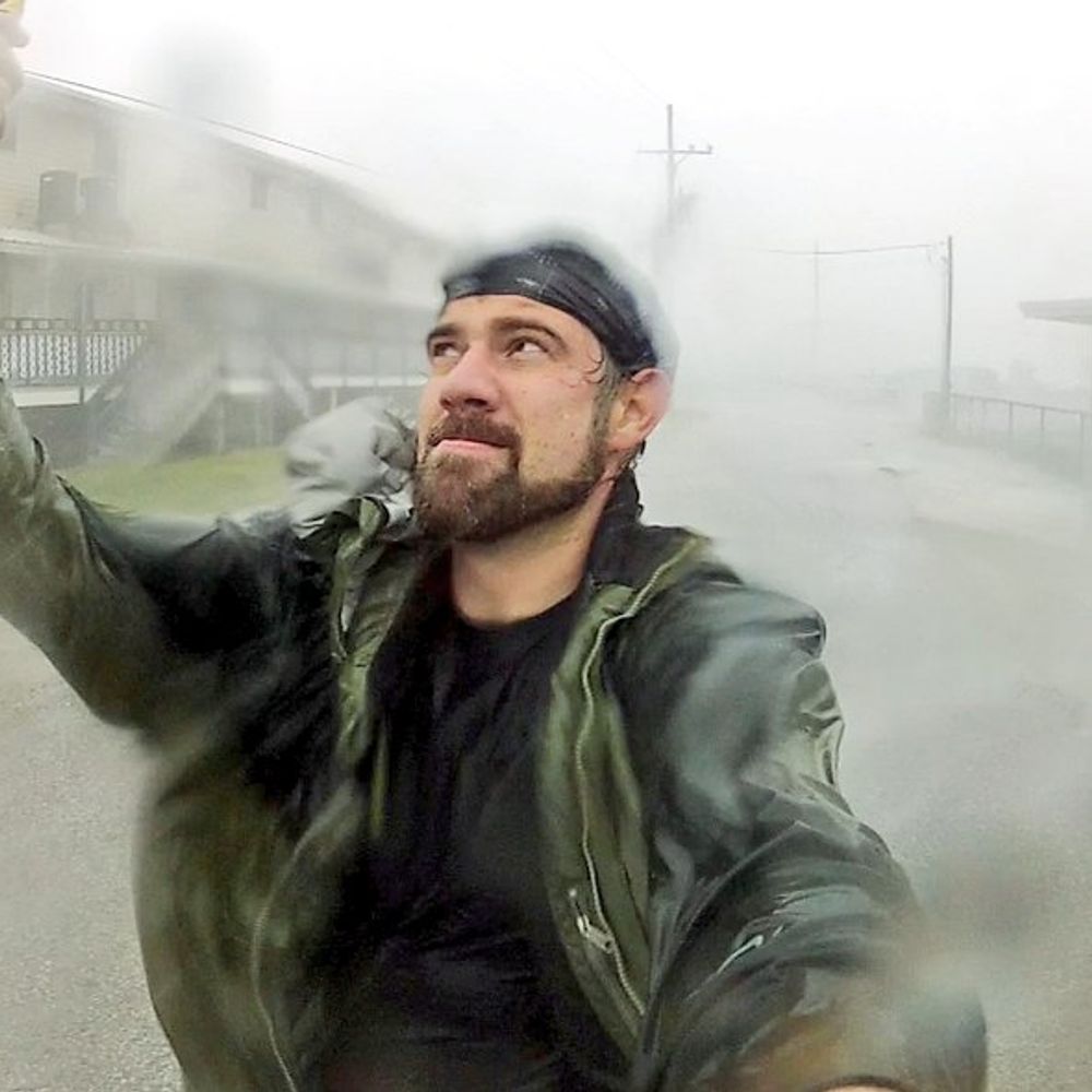
Intense convective snowband training off Lake Erie over Buffalo, NY creates what looks to be a WALL OF SNOW!
OTD 3 years ago, @ 3:36 AM EST 17 November 2022 from NW side of Buffalo looking south.
@NWSBUFFALO #NYwx


#NYwx #LakeEffect #snow #thundersnow