Danielle Madugo
@daniellemadugo.bsky.social
1.5K followers
110 following
67 posts
I'm an EQ geologist that is happy in a trench with a fault & my family with two minerals the hubs in there with me. Born at 334.9 ppm CO2 concentration.
Posts
Media
Videos
Starter Packs


Reposted by Danielle Madugo

Reposted by Danielle Madugo
Reposted by Danielle Madugo

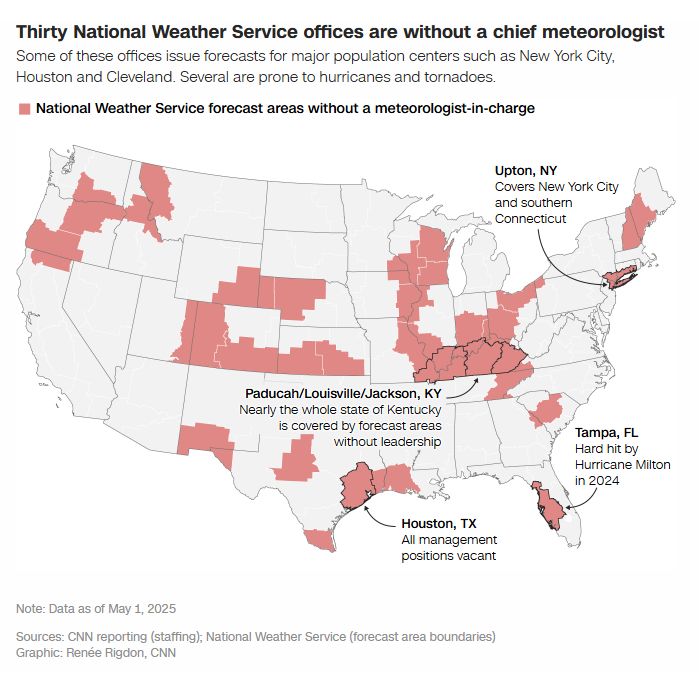
Daniel Swain
@weatherwest.bsky.social
· May 2

Reposted by Danielle Madugo
Reposted by Danielle Madugo

Reposted by Danielle Madugo

Reposted by Danielle Madugo
Reposted by Danielle Madugo