Martin Fleischmann
@martinfleischmann.net
2.7K followers
470 following
24 posts
Researcher. Cities, urban morphology, human geography & spatial data science. Open source software developer. #python #cities #open_science
https://martinfleischmann.net
Posts
Media
Videos
Starter Packs
Reposted by Martin Fleischmann

Martin Fleischmann
@martinfleischmann.net
· May 19
Computers, Environment and Urban Systems | ScienceDirect.com by Elsevier - Computers, Environment and Urban Systems | ScienceDirect.com by ElsevierScienceDirect
Read the latest articles of Computers, Environment and Urban Systems at ScienceDirect.com, Elsevier’s leading platform of peer-reviewed scholarly literature
www.sciencedirect.com
Reposted by Martin Fleischmann

Martin Fleischmann
@martinfleischmann.net
· Apr 29

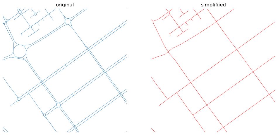
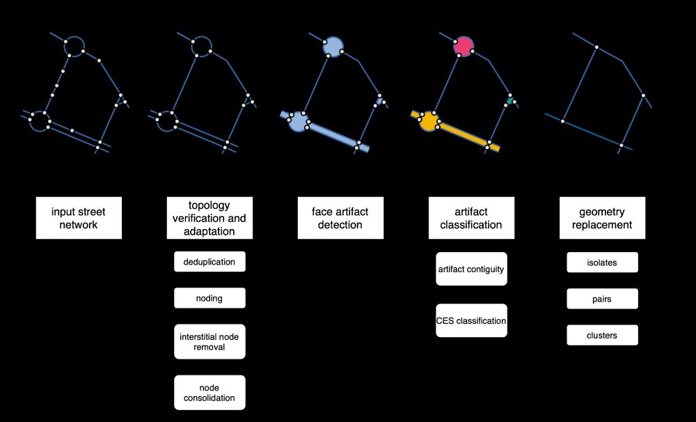
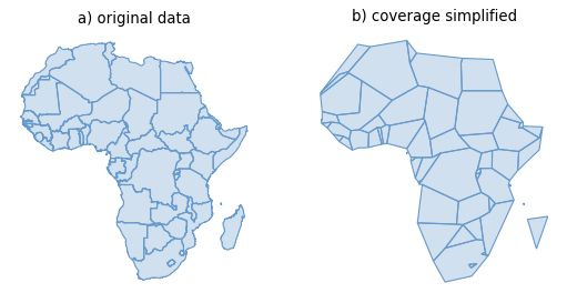
Adaptive continuity-preserving simplification of street networks
Street network data is widely used to study human-based activities and urban structure. Often, these data are geared towards transportation applications, which require highly granular, directed graphs...
arxiv.org

Martin Fleischmann
@martinfleischmann.net
· Apr 22
Reposted by Martin Fleischmann

Reposted by Martin Fleischmann

eli knaap
@knaaptime.com
· Feb 19
Martin Fleischmann
@martinfleischmann.net
· Feb 19

Reposted by Martin Fleischmann

Levi John Wolf
@levijohnwolf.bsky.social
· Dec 18
Reposted by Martin Fleischmann


Reposted by Martin Fleischmann


Martin Fleischmann
@martinfleischmann.net
· Nov 22
Martin Fleischmann
@martinfleischmann.net
· Nov 22
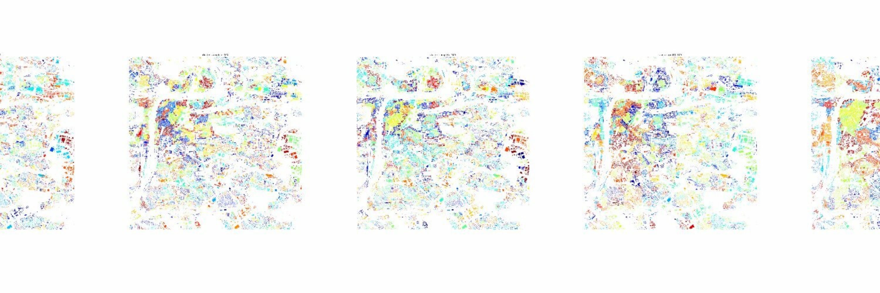
MoranPlot: Interactive plots for Local Moran's I analysis
Local Moran's I is a popular statistic in spatial analysis for measuring local spatial autocorrelation - used primarily for detecting spatial clusters. The statistic can provide powerful insights but ...
observablehq.com
Martin Fleischmann
@martinfleischmann.net
· Nov 21
Martin Fleischmann
@martinfleischmann.net
· Nov 13
Martin Fleischmann
@martinfleischmann.net
· Oct 31
Monitoring urban fabric for data-driven planning and decision-making
The event offers attendees the opportunity to be part of the EuroFab project, gathering their perspectives on how Earth Observation and AI can substantially change the way urban fabric data is produce...
wuf.unhabitat.org
Martin Fleischmann
@martinfleischmann.net
· Oct 28