milos makes maps
@milos-makes-maps.bsky.social
4.6K followers 230 following 540 posts
I paint the world with #rstats and teach you how to unleash your inner #map artist. Join my map adventures and tutorials now: https://youtube.com/@milos-makes-maps
Posts Media Videos Starter Packs
Pinned
milos-makes-maps.bsky.social
Hey everyone! 🌍 Welcome to my page! I'm Milos, and I bring the world to life with maps. 🎨 Join me on a journey to unleash your inner map artist. Enjoy my creations, connect with me, and dive into my map adventures and tutorials!

▶️ youtube.com/@milos-makes...)
Milos Makes Maps
I paint the world with R and teach you how to unleash your inner map artist. Join my map adventures and tutorials now!
youtube.com
milos-makes-maps.bsky.social
I’ve been deep in R for GIS mapping for years, but today marks a thrilling pivot: my very first Python tutorial is live!

We’ll extract Google’s latest satellite embeddings, run k-means analysis, and map our results

Everyone, watch the tutorial youtu.be/WjoB7mou2n8
Python: The Secret Weapon for Analyzing Google Earth Engine Data
YouTube video by Milos Makes Maps
youtu.be
milos-makes-maps.bsky.social
How far can you go in 30 minutes—from your doorstep? ⏱️
I just dropped a from-scratch tutorial to build travel-time maps in R (OSM → network → isochrones → crisp basemap).
Ship your city now.
🎥 Watch now: www.youtube.com/watch?v=M-O0...
30-Minute Travel Maps: The Secret to Fast Exploration
YouTube video by Milos Makes Maps
www.youtube.com
Reposted by milos makes maps
miskaknapek.bsky.social
#geodata #mapping #datavis

Precipitation (rain and snow) vs temperature in Germany

by @milos-makes-maps.bsky.social over on the birdsite
milos-makes-maps.bsky.social
Thank you dear Miska!
miskaknapek.bsky.social
#mapping #geodata #datavis #datascience

Iberian peninsula perspiration and temperature map
from @milos-makes-maps.bsky.social over on linkedin

tutorial:
lnkd.in/eYABTD6f

mapping book:
payhip.com/b/MH9Ot

linkedin post : www.linkedin.com/posts/milos-...
milos-makes-maps.bsky.social
Google Earth Engine now delivers annual 10 m Satellite Embeddings (64 bands per pixel!

In my new tutorial, I walk you through:
✅Loading & exploring AlphaEarth embeddings in R
✅Sampling & k-means clustering
✅Visualizing beautiful results

👉 youtu.be/dmtNAYb5woE

#GoogleEarthEngine #AlphaEarth #GIS
Revolutionizing Land Cover Analysis with Google Earth Engine!
YouTube video by Milos Makes Maps
youtu.be
milos-makes-maps.bsky.social
Earth Engine now hosts annual 10 m Satellite Embeddings (64 bands per pixel) powered by the new AlphaEarth Foundations model.

My next video on YouTube (milos-makes-maps) will show how to run part of its workflow in R. Subscribe to catch it 👉🏻 youtube.com/@milos-makes...

#AlphaEarth #Rstats #GIS
Milos Makes Maps
I paint the world with R and teach you how to unleash your inner map artist. Join my map adventures and tutorials now!
lnkd.in
milos-makes-maps.bsky.social
Thank you for spreading the word @miskaknapek.bsky.social ♥️
miskaknapek.bsky.social
#mapping #geodata Milos @milos-makes-maps.bsky.social notes on linkedin he's devleoping a python alternative to #rayshader in #Rlang.
Built with Vulkan + Rust + WebGPU :-)))

github repository:
github.com/milos-agatho...

- star the repository to help it gain traction
Reposted by milos makes maps
miskaknapek.bsky.social
ps. Milos here - @milos-makes-maps.bsky.social - has released a #GIS #geodata programming book with R #rlang

It ought to be good, knowing Milos.

payhip.com/b/MH9Ot
milos-makes-maps.bsky.social
Ready to create stunning 3D tree cover maps entirely for free?

My new tutorial guides you step-by-step on turning free satellite data from Google Dynamic World into high-quality visualizations.

Watch here 👉🏻 youtu.be/gyfy6HdbcLw

#GIS #RemoteSensing #3DMapping #ForestConservation #RStats
How to Make Awesome 3D Tree Cover Maps from Free Satellite Data!
YouTube video by Milos Makes Maps
youtu.be
Reposted by milos makes maps
koppenburg.ch
Beautiful and informative map 🇨🇭
milos-makes-maps.bsky.social
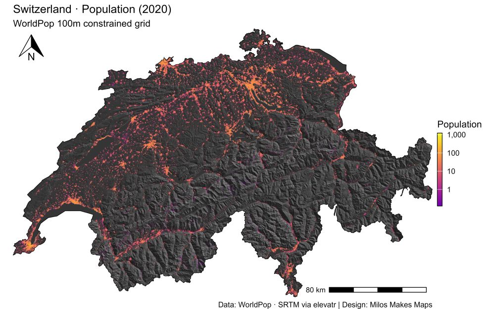
Want the secret to stunning maps like this Switzerland hillshade & population visualization?

My latest YouTube tutorial shows you exactly how!

🎬 Watch here 👉🏻 youtu.be/2dNIultQQ4Y

#GIS #Cartography #RStats #DataViz #MilosMakesMaps
A detailed thematic map of Switzerland visualizing 2020 population distribution using a logarithmic color scale over a shaded relief background. Bright orange and yellow tones indicate high population density areas like Zurich, Geneva, and Basel, while purple and black tones highlight sparsely populated alpine regions. The map includes a north arrow, population legend, and scale bar (80 km). Elevation is represented through 3D hillshading derived from SRTM data.
Data sources: WorldPop 100m constrained grid (2020); SRTM via the elevatr R package.
Map design: Milos Popovic (YouTube: Milos Makes Maps).
milos-makes-maps.bsky.social
Love it! Thank you for watching my tutorial!!
stevecarufel.bsky.social
Played with #Rstats and {rayshader} to make this #Quebec population density map, thanks to a tutorial by @milos-makes-maps.bsky.social ✌️⚜️

Code 👉 github.com/datacarvel/q...
Carte de la densité de population du Québec, faite avec {rayshader}
Quebec Population Density Map made with {rayshader}

Data from Kontur Population
Reposted by milos makes maps
hrbrmstr.dev
Better engage, folks. Otherwise, this content might only be fit for LinkedIn. You've been warned.
milos-makes-maps.bsky.social
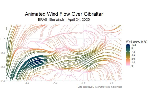
Want to turn raw wind data into a mesmerizing, animated map?
With R, it’s easier than you think.
My new tutorial shows you how, step by step.
Let’s catch the breeze. ⤵️
youtu.be/EmVbVTqwoMU

#GIS #DataViz #gganimate #metR #WindMap #ClimateData #SpatialAnalysis #MilosMakesMaps
This tutorial will level up your skills and show you how to build animated wind maps from scratch.

Watch it here: https://lnkd.in/e_8QaFn6

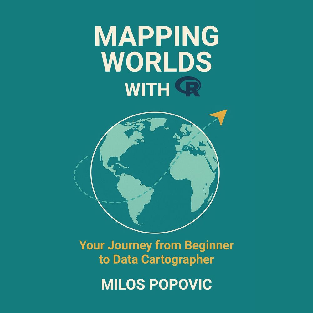
And if you’re ready to go deeper into the world of spatial data, check out my new book:
Mapping Worlds with R: Your Journey from Beginner to Data Cartographer
It’s packed with real projects, full code, and clear explanations for every step of the map-making process.

Grab the book: https://payhip.com/b/MH9Ot

Let’s catch the breeze, beautifully, in R.

#rstats #GIS #DataVisualization #ClimateData #ERA5 #gganimate #WindMapping #Geospatial #EnvironmentalScience #OpenData #MilosMakesMaps #MappingWithR
Reposted by milos makes maps
zmapper.bsky.social
This is neat!
milos-makes-maps.bsky.social
Want to turn raw wind data into a mesmerizing, animated map?
With R, it’s easier than you think.
My new tutorial shows you how, step by step.
Let’s catch the breeze. ⤵️
youtu.be/EmVbVTqwoMU

#GIS #DataViz #gganimate #metR #WindMap #ClimateData #SpatialAnalysis #MilosMakesMaps
This tutorial will level up your skills and show you how to build animated wind maps from scratch.

Watch it here: https://lnkd.in/e_8QaFn6

And if you’re ready to go deeper into the world of spatial data, check out my new book:
Mapping Worlds with R: Your Journey from Beginner to Data Cartographer
It’s packed with real projects, full code, and clear explanations for every step of the map-making process.

Grab the book: https://payhip.com/b/MH9Ot

Let’s catch the breeze, beautifully, in R.

#rstats #GIS #DataVisualization #ClimateData #ERA5 #gganimate #WindMapping #Geospatial #EnvironmentalScience #OpenData #MilosMakesMaps #MappingWithR
Reposted by milos makes maps
milos-makes-maps.bsky.social
Want to turn raw wind data into a mesmerizing, animated map?
With R, it’s easier than you think.
My new tutorial shows you how, step by step.
Let’s catch the breeze. ⤵️
youtu.be/EmVbVTqwoMU

#GIS #DataViz #gganimate #metR #WindMap #ClimateData #SpatialAnalysis #MilosMakesMaps
This tutorial will level up your skills and show you how to build animated wind maps from scratch.

Watch it here: https://lnkd.in/e_8QaFn6

And if you’re ready to go deeper into the world of spatial data, check out my new book:
Mapping Worlds with R: Your Journey from Beginner to Data Cartographer
It’s packed with real projects, full code, and clear explanations for every step of the map-making process.

Grab the book: https://payhip.com/b/MH9Ot

Let’s catch the breeze, beautifully, in R.

#rstats #GIS #DataVisualization #ClimateData #ERA5 #gganimate #WindMapping #Geospatial #EnvironmentalScience #OpenData #MilosMakesMaps #MappingWithR
milos-makes-maps.bsky.social
BlueSky still doesn't support GIF!?! 😡
milos-makes-maps.bsky.social
Want to turn raw wind data into a mesmerizing, animated map?
With R, it’s easier than you think.
My new tutorial shows you how, step by step.
Let’s catch the breeze. ⤵️
youtu.be/EmVbVTqwoMU

#GIS #DataViz #gganimate #metR #WindMap #ClimateData #SpatialAnalysis #MilosMakesMaps
This tutorial will level up your skills and show you how to build animated wind maps from scratch.

Watch it here: https://lnkd.in/e_8QaFn6

And if you’re ready to go deeper into the world of spatial data, check out my new book:
Mapping Worlds with R: Your Journey from Beginner to Data Cartographer
It’s packed with real projects, full code, and clear explanations for every step of the map-making process.

Grab the book: https://payhip.com/b/MH9Ot

Let’s catch the breeze, beautifully, in R.

#rstats #GIS #DataVisualization #ClimateData #ERA5 #gganimate #WindMapping #Geospatial #EnvironmentalScience #OpenData #MilosMakesMaps #MappingWithR
milos-makes-maps.bsky.social
Personally, I try to keep it real: I share tutorials, open data workflows, and lessons from my own trial-and-error. If that helps someone map their first river basin or make sense of elevation data, great. That’s the kind of engagement I’m there for, not just the algorithm chase.
milos-makes-maps.bsky.social
Some corners of LinkedIn definitely lean into that glossy, hustle-optimized aesthetic. But I've also found it to be a place where people genuinely discover useful resources, share knowledge, and connect around ideas, especially in the geospatial and R/data communities.
milos-makes-maps.bsky.social
Same, especially after that large influx from X last winter
milos-makes-maps.bsky.social
Definitely, LinkedIn brings the highest engagement
milos-makes-maps.bsky.social
🌬️ Ready to see the wind?

This Sunday, I’m dropping a new YouTube tutorial that shows you how to visualize wind flow like never before, using nothing but R.

We’ll map, animate, and decode wind patterns with stunning clarity.

Catch the breeze here 👇🏻👇🏻👇🏻 youtube.com/@milos-makes-maps
🌬️ Ready to see the wind?

This Sunday, I’m dropping a new YouTube tutorial that shows you how to visualize wind flow like never before, using nothing but R.

We’ll map, animate, and decode wind patterns with stunning clarity.

Catch the breeze here 👉🏻 youtube.com/@milos-makes-maps
Reposted by milos makes maps
milos-makes-maps.bsky.social
Format: PDF + GitHub
Pages: 233 (full color)
Skill Level: True beginner → confident mapper
Price: €19.99
Get it now 👇🏻

payhip.com/b/MH9Ot
Mapping worlds with R Your Journey from Beginner to Data Cartographer: https://payhip.com/b/MH9Ot
milos-makes-maps.bsky.social
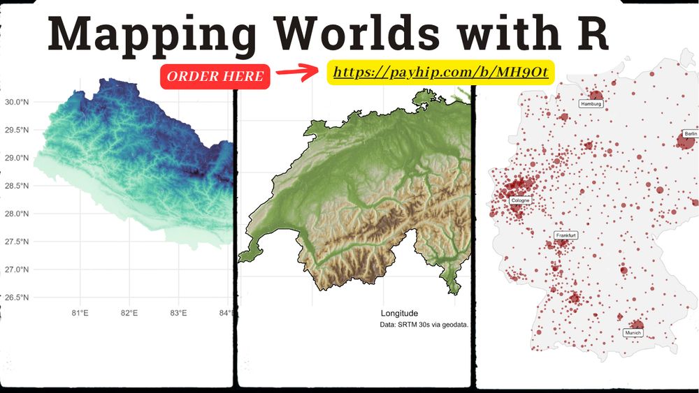
If you’ve ever thought “I wish I could make a map like that…”
This book turns that into “I did make a map like that.”

Let’s build something remarkable.

#RStats #Cartography #DataViz #GIS #MappingWithR #LearnToMap #Geospatial #ThreadsAcademia #OpenData

bsky.app/profile/milo...
milos-makes-maps.bsky.social
Want to learn mapmaking with real-world data even if you’ve never coded before?
Here’s the beginner-proof book that takes you from “How do I start?” to “Look what I just built in R.”
Let me show you. 👇🏻
Mapping worlds with R Your Journey from Beginner to Data Cartographer: https://payhip.com/b/MH9Ot