Pierre Markuse
@pierremarkuse.bsky.social
1.8K followers 920 following 14 posts
Never stop being curious! Mostly optical remote sensing🛰️ with a focus on #wildfires🔥 and #SciComm. Some #wx . Sat images on Flickr ▶️ https://flickr.com/photos/pierre_markuse/ Linktree ▶️ https://linktr.ee/pierre_markuse
Posts Media Videos Starter Packs
pierremarkuse.bsky.social
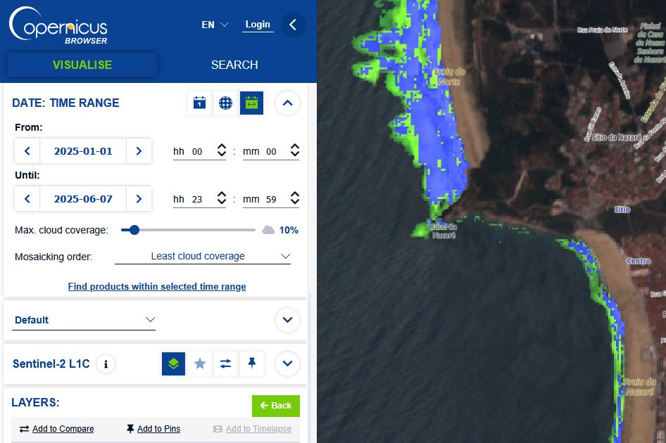
🟢 Worth a read if you are using the Copernicus Browser and custom scripts. „Sentinel Hub Custom Scripts migration from EO Browser to Copernicus Browser“ by Mohor Gartner
medium.com/@mohor.gartn...
Sentinel Hub Custom Scripts migration from EO Browser to Copernicus Browser
Platform migration and update of my scripts.
medium.com
Reposted by Pierre Markuse
aerosolwatch.bsky.social
Fire radiative power from the VIIRS sensor on @noaa.gov NOAA-21 satellite observed an intensely burning wildfire (orange markers) in western Turkey yesterday 29 Jun, which emitted a thick, brown-colored smoke plume that blew offshore. @mparrington.bsky.social @pierremarkuse.bsky.social
Reposted by Pierre Markuse
mparrington.bsky.social
#SaharanDust contributing high surface PM10 concentrations across the Caribbean, Greater Antilles & Gulf of Mexico, with more crossing N Atlantic, in the #CopernicusAtmosphere forecast initialized 28 June 00UTC atmosphere.copernicus.eu/charts/packa... @copernicusecmwf.bsky.social @ecmwf.int
Reposted by Pierre Markuse
aerosolwatch.bsky.social
Thick smoke (dark red shading) from ongoing seasonal wildfires in Siberia Russia covered a large area near the borders with China & Mongolia today 26 Jun, observed by @noaa.gov VIIRS aerosol optical depth from the NOAA-21 satellite. @mparrington.bsky.social @pierremarkuse.bsky.social
Reposted by Pierre Markuse
aerosolwatch.bsky.social
Wildfires on the eastern Greek island of Chios emitted thick smoke that blew southwestward on 23 Jun, observed by @noaa.gov VIIRS aerosol optical depth (AOD >0.5). Also evident is a small plume from a wildfire near Papadianika in southern Greece. @mparrington.bsky.social @pierremarkuse.bsky.social
Reposted by Pierre Markuse
mparrington.bsky.social
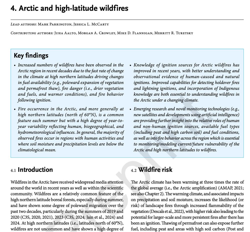
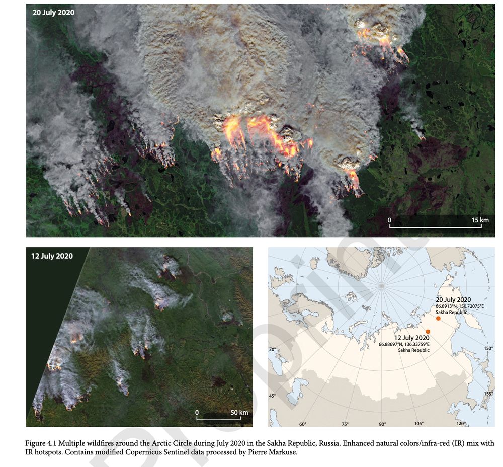
First look at preprint of the AMAP Arctic Climate Change Update 2024 report www.amap.no/documents/do... and Chapter 4 on #Arctic & high-latitude #wildfires with thanks to co-authors @jmccartygeo.bsky.social Juha Aalto @morganahcrowley.bsky.social @queenofpeat.bsky.social & @mikeflannigan.bsky.social
Reposted by Pierre Markuse
mparrington.bsky.social
Latest #CopernicusAtmosphere AOD forecast (from 30/05 00 UTC) shows smoke plume from devastating (&growing) Canadian #wildfires continuing across the Atlantic with hazy skies for Europe over next few days atmosphere.copernicus.eu/charts/packa... @copernicusecmwf.bsky.social @ecmwf.int
Reposted by Pierre Markuse
mparrington.bsky.social
Huge smoke plumes from many #wildfires burning in the far east of Russia in #CopernicusAtmosphere organic matter aerosol optical depth forecast initialised on 14 May at 00 UTC. Daily updated charts available at atmosphere.copernicus.eu/charts/packa... @copernicusecmwf.bsky.social @ecmwf.int
pierremarkuse.bsky.social
🟠 Mount Etna volcano lava flow (3D), February 17th, 2025🌋, #Sicily, #Italy🇮🇹 - February 17th, 2025 #Copernicus🇪🇺 #Sentinel-2🛰️ Full-size ▶️ flic.kr/p/2qQqXhH #OpenData #SciComm #Volcano #Etna Image is about 12 kilometers wide
pierremarkuse.bsky.social
🔴 I've never been the biggest fan of Justin #Trudeau, but his speech was amazing. This is just a short part of it. Donald #Trump is burning bridges left and right and is steering the US into a future that is appearing darker and darker. #Canada🇨🇦
www.youtube.com/watch?v=vOhp...
US Canada Tariff | "We Fought, Died With You": Canadian PM Trudeau's Emotional Message To Americans
YouTube video by NDTV
www.youtube.com
pierremarkuse.bsky.social
🔵🟡 This deal would be a big mistake in my opinion. It's time for #Europe🇪🇺 and other countries to stay united behind #Ukraine🇺🇦. I hope Zelenskyy will find another way. Don't seek help from a country run by and for the wealthy. They will betray you. They will betray you...
pierremarkuse.bsky.social
🔵🟡 I can only hope Europe🇪🇺 will stay united behind Ukraine and help. #Trump and #Vance created a show to score points with their #MAGA people but #Zelenskyy is the true leader and winner here, taking it to show the world how insane US politics have become. #SlavaUkraini🇺🇦
pierremarkuse.bsky.social
Well that image is L2 data and maybe I'm blind but I do not see any artifact? Can you be more specific what you mean and maybe include a link to the scene?
Reposted by Pierre Markuse
dpmanchee.bsky.social
The Tasmanian wildfires that are generating high levels of aerosols have very large fire fronts 😬

Copernicus #Sentinel2 data acquired 10th Feb 2024 link.dataspace.copernicus.eu/7xny

Images from Copernicus Browser using @pierremarkuse.bsky.social wildfire script
Reposted by Pierre Markuse
aerosolwatch.bsky.social
Thick smoke (dark purple shading) from ongoing bushfires in Tasmania Australia blew westward over the Indian Ocean today 10 Feb, observed by VIIRS aerosol detection from the @noaa.gov NOAA-21 satellite. @mparrington.bsky.social @pierremarkuse.bsky.social
Reposted by Pierre Markuse
dpmanchee.bsky.social
Extent of burns scars and destruction from California wildfires clearly visible in this 🇪🇺 Copernicus #Sentinel2 imagery from 12th Jan 2025. SWIR RGB shown uses bands 12, 8A and 4 - link.dataspace.copernicus.eu/8fq4

Stay safe everyone.

@pierremarkuse.bsky.social @mparrington.bsky.social
Reposted by Pierre Markuse
ericholthaus.com
The most destructive fire in Southern California history was the 2003 Cedar fire in San Diego with 2,820 structures destroyed.

The #Eaton fire in Pasadena threatens 28,000.
bsky.app/profile/edwa...
Top 20 Most Destructive California Wildfires
Rank Fire name (cause) Date County Size in acres Structures destroyed Fatalities
1 CAMP (Powerlines) November 2018 Butte 153,336 18,804 85
2 TUBBS (Electrical) October 2017 Napa & Sonoma 36,807 5,636 22
3 TUNNEL - Oakland Hills (Rekindle) October 1991 Alameda 1,600 2,900 25
4 CEDAR (Human Related) October 2003 San Diego 273,246 2,820 15
5 NORTH COMPLEX (Lightning) August, 2020 Butte, Plumas, & Yuba 318,935 2,352 15
6 VALLEY (Electrical) September 2015 Lake, Napa & Sonoma 76,067 1,955 4
7 WITCH (Powerlines) October 2007 San Diego 197,990 1,650 2
8 WOOLSEY (Electrical) November 2018 Ventura 96,949 1,643 3
9 CARR (Human Related) July 2018 Shasta County, Trinity 229,651 1,614 8
10 GLASS (Undetermined ) September 2020 Napa & Sonoma 67,484 1,520 0
11 LNU LIGHTNING COMPLEX
(Lightning/Arson) August 2020 Napa, Solano, Sonoma, Yolo,
Lake, & Colusa 363,220 1,491 6
12 CZU LIGHTNING COMPLEX (Lightning) August 2020 Santa Cruz, San Mateo 86,509 1,490 1
13 NUNS (Powerlines) October 2017 Sonoma 54,382 1,355 3
14 DIXIE (Powerlines) July 2021 Butte, Plumas, Lassen, & Tehama 963,309 1,311 1
15 THOMAS (Powerlines) December 2017 Ventura & Santa Barbara 281,893 1,063 2
16 CALDOR(Under Investigation) September 2021 Alpine, Amador, & El Dorado 221,774 1,003 1
17 OLD (Human Related) October 2003 San Bernardino 91,281 1,003 6
18 JONES (Undetermined) October 1999 Shasta 26,200 954 1
19 AUGUST COMPLEX (Lightning) August 2020 Mendocino, Humboldt, Trinity, Tehama,
Glenn, Lake, & Colusa 1,032,648 935 1
20 BUTTE (Powerlines) September 2015 Amador & Calaveras 70,868 921 2
Reposted by Pierre Markuse
dpmanchee.bsky.social
Home Reef, Tonga continues to grow.

One year timelapse of Copernicus #Sentinel2. Image via Copernicus Browser, using @pierremarkuse.bsky.social's wildfire script.

link.dataspace.copernicus.eu/6aua
Reposted by Pierre Markuse
queenofpeat.bsky.social
Unstable trees - aka drunken forest - at the edge of a thaw lake in interior Alaska. As more permafrost thaws at the edges of the lake, it will erode into the forest, flooding and killing the trees.
Reposted by Pierre Markuse
chadloder.bsky.social
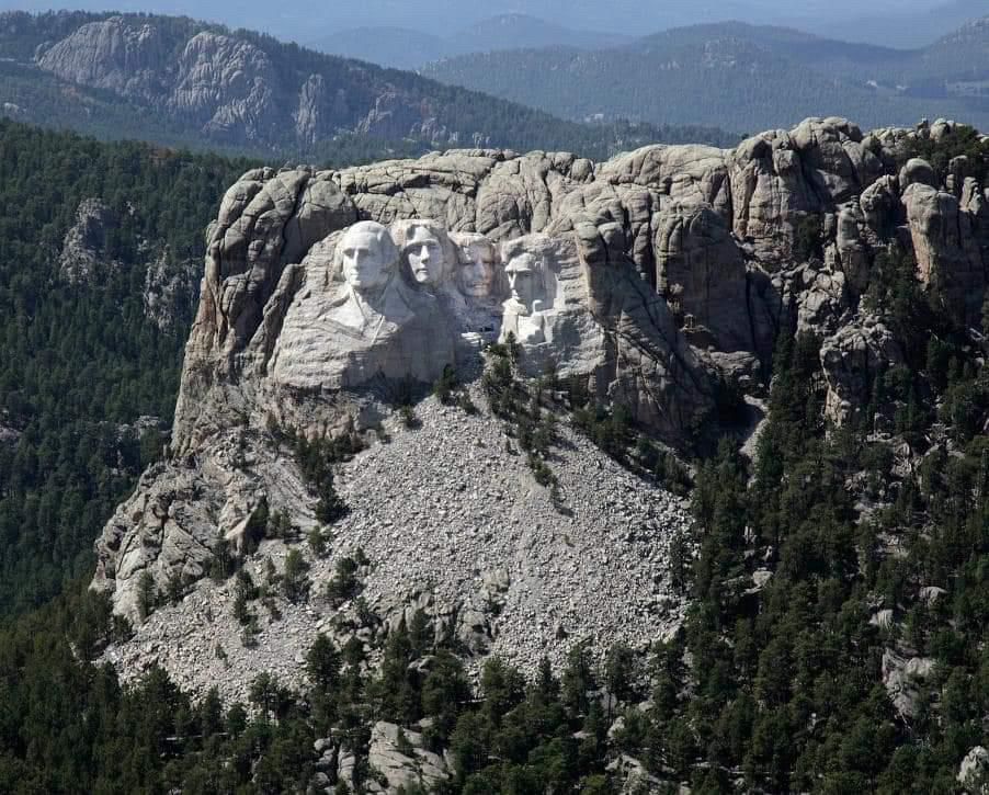
When you view Mount Rushmore against the background of the sacred Black Hills site which it desecrated, you realize how hideous and pathetic it is. Truly a vulgar monstrosity.
The carved faces of Mount Rushmore looking small and pathetic against the stunning landscape of the Black Hills
pierremarkuse.bsky.social
🔵 Since I am still relatively new here, some of you might not know that most of my sat images are available full-size on my Flickr here ▶️ www.flickr.com/photos/pierr... Over 2,600 satellite🛰️ images and a few videos now, almost all CC-BY licensed, so free to use. #RemoteSensing #OpenData
pierremarkuse.bsky.social
🟠 Reykjanes Peninsula #Volcano🌋 eruption, #Iceland🇮🇸 - November 24th, 2024 #Landsat-9🛰️ Full-size ▶️ flic.kr/p/2qw23Mc #OpenData #RemoteSensing Image is about 14 kilometers wide #IcelandVolcano #Grindavik #Reykjanes
pierremarkuse.bsky.social
Thank you, the school of my sister's children had to close a few days for cleaning inside as well as replacing all the sand on the playground and cleaning of the asphalt to make sure there were no asbestos fibers left, but it seems like exposure, if it at all happened, was minimal.
pierremarkuse.bsky.social
🟠 Usually posting sat images, but here are two pictures (taken by my sister) of the burning🔥 cooling tower of the defunct coal mine "Heinrich Robert" in Hamm, Germany, on November 4th, 2024. It spread some asbestos around. More info (German) ▶️ wa.de/hamm/brand-h...
pierremarkuse.bsky.social
🟠 Mount Lewotobi #Volcano🌋, Flores, #Indonesia🇮🇩 - November 13th, 2024 #Copernicus🇪🇺 #Sentinel-2🛰️ Full-size ▶️ flic.kr/p/2qu1Zsp #OpenData #SciComm Image is about 16 kilometers wide #Lewotobi