


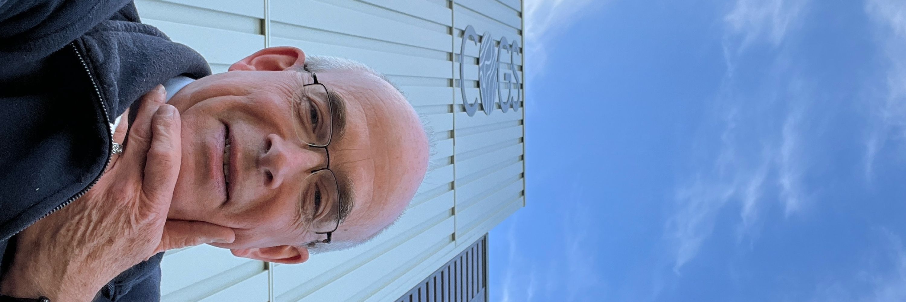
Dave MacLean
@daveatcogs.bsky.social
GIS Faculty, Centre of Geographic Sciences (COGS); Fellow, Royal Canadian Geographical Society; co-Director, Esri Canada Centre of Excellence (COGS). My posts
Just getting started on bluesky
Astronaut photos-of-Earth maps: https://isspix.com/MapTourHowTo
Just getting started on bluesky
Astronaut photos-of-Earth maps: https://isspix.com/MapTourHowTo
Reposted by Dave MacLean

Friends, I’d like to show @ucalgary.bsky.social that @bsky.app is where the cool kids hang out and that they should start posting here more and less/none at TheBadPlace™️. Show them some love by reskeeting this 100000000x. 🧪
January 22, 2026 at 12:42 AM
Friends, I’d like to show @ucalgary.bsky.social that @bsky.app is where the cool kids hang out and that they should start posting here more and less/none at TheBadPlace™️. Show them some love by reskeeting this 100000000x. 🧪
Reposted by Dave MacLean
Just one more image of the amazing #auroraborealis of last 19 January. Taken from my city garden. The bright spot in the centre is planet Jupiter. The view is towards southeast, with the aurora high in my southern sky at 52 degrees north! @daveatcogs.bsky.social @elisabethkosters.bsky.social

January 21, 2026 at 9:47 PM
Just one more image of the amazing #auroraborealis of last 19 January. Taken from my city garden. The bright spot in the centre is planet Jupiter. The view is towards southeast, with the aurora high in my southern sky at 52 degrees north! @daveatcogs.bsky.social @elisabethkosters.bsky.social
Reposted by Dave MacLean

Day 20 of #365DaysOfMaps. January 20th is Penguin Awareness Day. I don't think they mean the chocolate bar variety.
Penguins of Antarctica 20/365
mapdesign.icaci.org/2026/01/happ...
Penguins of Antarctica 20/365
mapdesign.icaci.org/2026/01/happ...

January 20, 2026 at 9:06 AM
Day 20 of #365DaysOfMaps. January 20th is Penguin Awareness Day. I don't think they mean the chocolate bar variety.
Penguins of Antarctica 20/365
mapdesign.icaci.org/2026/01/happ...
Penguins of Antarctica 20/365
mapdesign.icaci.org/2026/01/happ...
Reposted by Dave MacLean
Today's view of Piton de la Fournaise lava flows in Reunion Island.
Area not far from Piton Kapor.
Image taken by Sentinel-2.
Area not far from Piton Kapor.
Image taken by Sentinel-2.

January 20, 2026 at 10:35 AM
Today's view of Piton de la Fournaise lava flows in Reunion Island.
Area not far from Piton Kapor.
Image taken by Sentinel-2.
Area not far from Piton Kapor.
Image taken by Sentinel-2.
Reposted by Dave MacLean
Heart-shaped sediment plume in Lake General Carrera in Chile.
Image taken by Sentinel-2 on Jan. 19, 2026.
Image taken by Sentinel-2 on Jan. 19, 2026.

January 20, 2026 at 12:34 AM
Heart-shaped sediment plume in Lake General Carrera in Chile.
Image taken by Sentinel-2 on Jan. 19, 2026.
Image taken by Sentinel-2 on Jan. 19, 2026.
Reposted by Dave MacLean
Nice pass of space station #ISS tonight through a sky full of haze and veil clouds. Image taken 19 January 2026 17:43:15 UT. @leonoor.bsky.social @daveatcogs.bsky.social

January 19, 2026 at 6:13 PM
Nice pass of space station #ISS tonight through a sky full of haze and veil clouds. Image taken 19 January 2026 17:43:15 UT. @leonoor.bsky.social @daveatcogs.bsky.social
Reposted by Dave MacLean

This Canadian snowman has his Elbows Up!!

January 19, 2026 at 7:15 PM
This Canadian snowman has his Elbows Up!!
Reposted by Dave MacLean
Good morning! It’s going to snow shortly, so it’s a dark sunrise, but the sound and rhythm of the waves is lovely.
Have a 5-minute breathe-and-reset with #OceanDevotion
Have a 5-minute breathe-and-reset with #OceanDevotion

Wiinter beach sunrise, peaceful waves sounds for meditation, Cape Cod
YouTube video by Ocean Devotion
youtu.be
January 18, 2026 at 12:51 PM
Good morning! It’s going to snow shortly, so it’s a dark sunrise, but the sound and rhythm of the waves is lovely.
Have a 5-minute breathe-and-reset with #OceanDevotion
Have a 5-minute breathe-and-reset with #OceanDevotion
Reposted by Dave MacLean

🌄 Good morning! The Osinov Pass is the last major hurdle before travelers coming from Oskemen reach the Altai Mountains of #Kazakhstan. The view from the pass summit is particularly impressive at sunrise. Have a wonderful Sunday. 🤗
#Photography #Stunday #Nature #Landscape #CentralAsia #Scape #Drone
#Photography #Stunday #Nature #Landscape #CentralAsia #Scape #Drone

January 18, 2026 at 9:47 AM
🌄 Good morning! The Osinov Pass is the last major hurdle before travelers coming from Oskemen reach the Altai Mountains of #Kazakhstan. The view from the pass summit is particularly impressive at sunrise. Have a wonderful Sunday. 🤗
#Photography #Stunday #Nature #Landscape #CentralAsia #Scape #Drone
#Photography #Stunday #Nature #Landscape #CentralAsia #Scape #Drone
Reposted by Dave MacLean

Whole area with the large shadows of
ARTEMIS II on the way and also of the
Vehicle Assembly Building
📸🛰 #Sentinel2 2026.01.17
ARTEMIS II on the way and also of the
Vehicle Assembly Building
📸🛰 #Sentinel2 2026.01.17

January 18, 2026 at 12:32 AM
Whole area with the large shadows of
ARTEMIS II on the way and also of the
Vehicle Assembly Building
📸🛰 #Sentinel2 2026.01.17
ARTEMIS II on the way and also of the
Vehicle Assembly Building
📸🛰 #Sentinel2 2026.01.17
Reposted by Dave MacLean
This behemoth machine is carrying the Artemis 2 Moon rocket out to the launch pad. It carried the Shuttles I launched in too. A massive, clanking crawler and skilled crew, taking infinite care.
Watch live: youtube.com/live/nrVnsO_rd…
Watch live: youtube.com/live/nrVnsO_rd…

January 17, 2026 at 12:54 PM
This behemoth machine is carrying the Artemis 2 Moon rocket out to the launch pad. It carried the Shuttles I launched in too. A massive, clanking crawler and skilled crew, taking infinite care.
Watch live: youtube.com/live/nrVnsO_rd…
Watch live: youtube.com/live/nrVnsO_rd…
Reposted by Dave MacLean
Good morning! A longer #OceanDevotion for you this morning. Make a cup of tea and just breathe as the sky lights up.

15 minutes of increasingly vibrant winter beach sunrise, peaceful wave sounds, Cape Cod
YouTube video by Ocean Devotion
youtu.be
January 17, 2026 at 12:55 PM
Good morning! A longer #OceanDevotion for you this morning. Make a cup of tea and just breathe as the sky lights up.
Reposted by Dave MacLean

Artemis II: The mission that is sending a Canadian farther into space than ever before. Swipe to learn why it matters. 🌕🚀


January 16, 2026 at 9:08 PM
Artemis II: The mission that is sending a Canadian farther into space than ever before. Swipe to learn why it matters. 🌕🚀
Reposted by Dave MacLean
This week’s #ShareCanGeo spotlight goes to Amedeo Cortese (IG: @wildlifephotosbydeo) and this unforgettable moment with a coastal wolf.
How would you #CaptionThis? Drop your best line in the comments below ⬇️
How would you #CaptionThis? Drop your best line in the comments below ⬇️

January 16, 2026 at 10:05 PM
This week’s #ShareCanGeo spotlight goes to Amedeo Cortese (IG: @wildlifephotosbydeo) and this unforgettable moment with a coastal wolf.
How would you #CaptionThis? Drop your best line in the comments below ⬇️
How would you #CaptionThis? Drop your best line in the comments below ⬇️
Reposted by Dave MacLean
🌇 Good morning! The main axes of Astana, the modern capital of #Kazakhstan, follow a distinct symmetrical pattern. 🏙️ Doesn't that just invite architecture enthusiasts like us to take photos? We wish you a wonderful Friday! 🤗
#Cityscape #Scape #Photography #EastCoastKin #CentralAsia #Architecture
#Cityscape #Scape #Photography #EastCoastKin #CentralAsia #Architecture

January 16, 2026 at 10:55 AM
🌇 Good morning! The main axes of Astana, the modern capital of #Kazakhstan, follow a distinct symmetrical pattern. 🏙️ Doesn't that just invite architecture enthusiasts like us to take photos? We wish you a wonderful Friday! 🤗
#Cityscape #Scape #Photography #EastCoastKin #CentralAsia #Architecture
#Cityscape #Scape #Photography #EastCoastKin #CentralAsia #Architecture
Reposted by Dave MacLean
Folded rocks in Morocco.
Image taken by Sentinel-2 on Jan. 13, 2026.
Image taken by Sentinel-2 on Jan. 13, 2026.

January 15, 2026 at 9:24 PM
Folded rocks in Morocco.
Image taken by Sentinel-2 on Jan. 13, 2026.
Image taken by Sentinel-2 on Jan. 13, 2026.
Reposted by Dave MacLean
Some cool rocks in NW Algeria.
Image taken by Sentinel-2 on Dec. 31, 2025.
Image taken by Sentinel-2 on Dec. 31, 2025.

January 15, 2026 at 4:28 PM
Some cool rocks in NW Algeria.
Image taken by Sentinel-2 on Dec. 31, 2025.
Image taken by Sentinel-2 on Dec. 31, 2025.
Reposted by Dave MacLean
Richat Structure in Mauritania.
Image taken by Sentinel-2 on Dec. 31, 2025.
Image taken by Sentinel-2 on Dec. 31, 2025.

January 14, 2026 at 10:23 PM
Richat Structure in Mauritania.
Image taken by Sentinel-2 on Dec. 31, 2025.
Image taken by Sentinel-2 on Dec. 31, 2025.
Reposted by Dave MacLean
STILL CONSUMES —— What the midwinter melt doesn't touch will help the next freeze claiming back. All those built-up borders slowly spilled over, holding fast for the next... [Read More: IG, FB, Patreon, Substack]
January 12, 2026
Clementsport, Nova Scotia
Year 19, Day 6637 of my daily journal.
January 12, 2026
Clementsport, Nova Scotia
Year 19, Day 6637 of my daily journal.

January 14, 2026 at 10:24 PM
STILL CONSUMES —— What the midwinter melt doesn't touch will help the next freeze claiming back. All those built-up borders slowly spilled over, holding fast for the next... [Read More: IG, FB, Patreon, Substack]
January 12, 2026
Clementsport, Nova Scotia
Year 19, Day 6637 of my daily journal.
January 12, 2026
Clementsport, Nova Scotia
Year 19, Day 6637 of my daily journal.
Reposted by Dave MacLean
Lake Jingyu Hu in western China.
Image taken by Sentinel-2 on Nov. 14, 2025.
h/t @brockmannconsult.bsky.social 😊👍
Image taken by Sentinel-2 on Nov. 14, 2025.
h/t @brockmannconsult.bsky.social 😊👍

January 14, 2026 at 12:27 PM
Lake Jingyu Hu in western China.
Image taken by Sentinel-2 on Nov. 14, 2025.
h/t @brockmannconsult.bsky.social 😊👍
Image taken by Sentinel-2 on Nov. 14, 2025.
h/t @brockmannconsult.bsky.social 😊👍
Reposted by Dave MacLean

Read all about it!
The latest news about, from, and for students, staff, alumni, and friends of the University of King's College MFA in Creative Nonfiction and Fiction programs:
ukcmfaprograms.substack.com/p/mfa-newsle...
@kingsjournalism.bsky.social @kingsbookstore.bsky.social
The latest news about, from, and for students, staff, alumni, and friends of the University of King's College MFA in Creative Nonfiction and Fiction programs:
ukcmfaprograms.substack.com/p/mfa-newsle...
@kingsjournalism.bsky.social @kingsbookstore.bsky.social

MFA Newsletter Winter 2026
News about, from, and for students, staff, alumni, and friends of the University of King's College Writing & Publishing Program.
ukcmfaprograms.substack.com
January 14, 2026 at 7:56 PM
Read all about it!
The latest news about, from, and for students, staff, alumni, and friends of the University of King's College MFA in Creative Nonfiction and Fiction programs:
ukcmfaprograms.substack.com/p/mfa-newsle...
@kingsjournalism.bsky.social @kingsbookstore.bsky.social
The latest news about, from, and for students, staff, alumni, and friends of the University of King's College MFA in Creative Nonfiction and Fiction programs:
ukcmfaprograms.substack.com/p/mfa-newsle...
@kingsjournalism.bsky.social @kingsbookstore.bsky.social
Reposted by Dave MacLean

'Dragon Moon'
Source photography by Jonny Kim is repaired, remastered & retimed.
The 4k UHD video with music by Chris Zabriskie can be viewed here...
youtu.be/Cp4Xqa9LBA8
Source photography by Jonny Kim is repaired, remastered & retimed.
The 4k UHD video with music by Chris Zabriskie can be viewed here...
youtu.be/Cp4Xqa9LBA8

December 24, 2025 at 3:45 PM
'Dragon Moon'
Source photography by Jonny Kim is repaired, remastered & retimed.
The 4k UHD video with music by Chris Zabriskie can be viewed here...
youtu.be/Cp4Xqa9LBA8
Source photography by Jonny Kim is repaired, remastered & retimed.
The 4k UHD video with music by Chris Zabriskie can be viewed here...
youtu.be/Cp4Xqa9LBA8
Reposted by Dave MacLean

January 14, 2026 at 8:35 AM
Reposted by Dave MacLean
Good morning! 🌄 We arrived the middle of the week. So we hope this photo of the Kaindy waterfall in #Kazakhstan brings you some fresh spirit for your mind. ⛲ Have a wonderful Wednesday, everyone. 🤗
#Landscape #Nature #Scape #PhotoHour #WaterfallWednesday #CentralAsia #Photography #EastCostKin
#Landscape #Nature #Scape #PhotoHour #WaterfallWednesday #CentralAsia #Photography #EastCostKin

January 14, 2026 at 10:24 AM
Good morning! 🌄 We arrived the middle of the week. So we hope this photo of the Kaindy waterfall in #Kazakhstan brings you some fresh spirit for your mind. ⛲ Have a wonderful Wednesday, everyone. 🤗
#Landscape #Nature #Scape #PhotoHour #WaterfallWednesday #CentralAsia #Photography #EastCostKin
#Landscape #Nature #Scape #PhotoHour #WaterfallWednesday #CentralAsia #Photography #EastCostKin
Reposted by Dave MacLean
'Airglow America'
Airglow & a faint aurora heading into the west coast...
3,335 images from a time-lapse sequence photographed by Jonny Kim are repaired, remastered & retimed to create 4k UHD 3x real time video footage.
Credit: Jonny Kim / ISS / NASA / ESRS / Seán Doran
youtu.be/5n7Zhfi7Y_M
Airglow & a faint aurora heading into the west coast...
3,335 images from a time-lapse sequence photographed by Jonny Kim are repaired, remastered & retimed to create 4k UHD 3x real time video footage.
Credit: Jonny Kim / ISS / NASA / ESRS / Seán Doran
youtu.be/5n7Zhfi7Y_M

ISS - Airglow America
YouTube video by Seán Doran
youtu.be
December 17, 2025 at 7:15 PM
'Airglow America'
Airglow & a faint aurora heading into the west coast...
3,335 images from a time-lapse sequence photographed by Jonny Kim are repaired, remastered & retimed to create 4k UHD 3x real time video footage.
Credit: Jonny Kim / ISS / NASA / ESRS / Seán Doran
youtu.be/5n7Zhfi7Y_M
Airglow & a faint aurora heading into the west coast...
3,335 images from a time-lapse sequence photographed by Jonny Kim are repaired, remastered & retimed to create 4k UHD 3x real time video footage.
Credit: Jonny Kim / ISS / NASA / ESRS / Seán Doran
youtu.be/5n7Zhfi7Y_M