Chris Wilson
@crwilson84.bsky.social
36 followers
28 following
42 posts
Ōtautahi Christchurch, Waitaha Canterbury, Aotearoa New Zealand
Posts
Media
Videos
Starter Packs


Reposted by Chris Wilson


Chris Wilson
@crwilson84.bsky.social
· Aug 31
Chris Wilson
@crwilson84.bsky.social
· Aug 31


Chris Wilson
@crwilson84.bsky.social
· Aug 27
Chris Wilson
@crwilson84.bsky.social
· Aug 26
Chris Wilson
@crwilson84.bsky.social
· Aug 22
Reposted by Chris Wilson

Chris Wilson
@crwilson84.bsky.social
· Jul 30


Reposted by Chris Wilson

Reposted by Chris Wilson
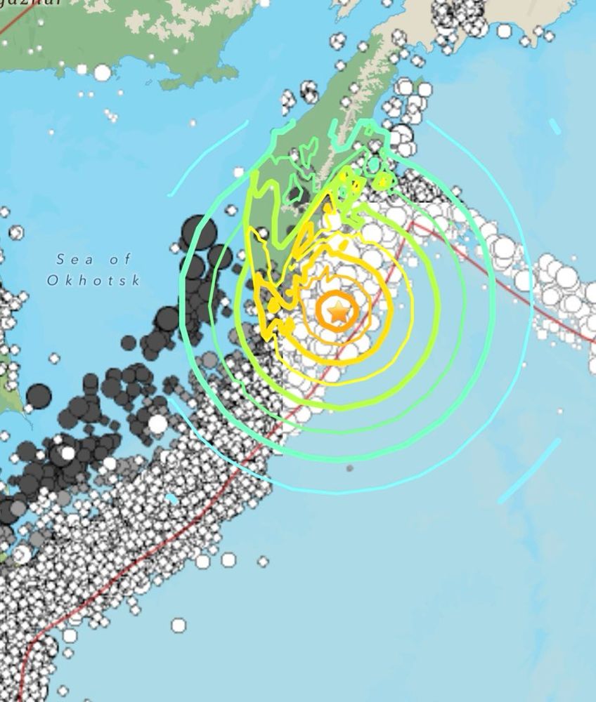
Dr. Wendy Bohon
@drwendyrocks.bsky.social
· Jul 30
Chris Wilson
@crwilson84.bsky.social
· Jul 30
Chris Wilson
@crwilson84.bsky.social
· Jul 30

Reposted by Chris Wilson
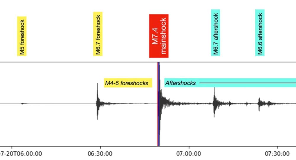
Chris Wilson
@crwilson84.bsky.social
· Jul 20
Reposted by Chris Wilson

Laura Helmuth
@laurahelmuth.bsky.social
· Jun 18
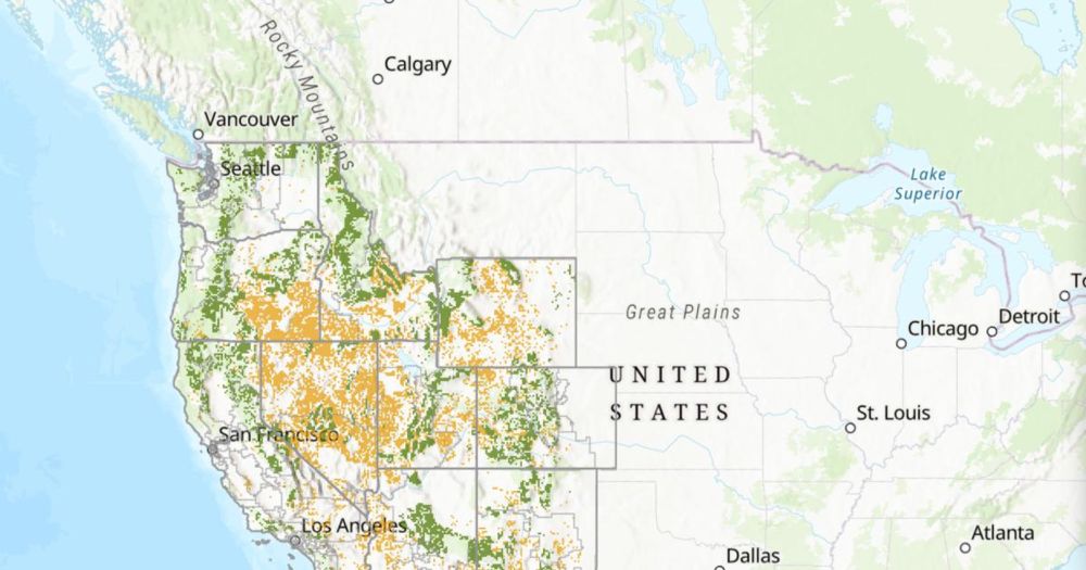
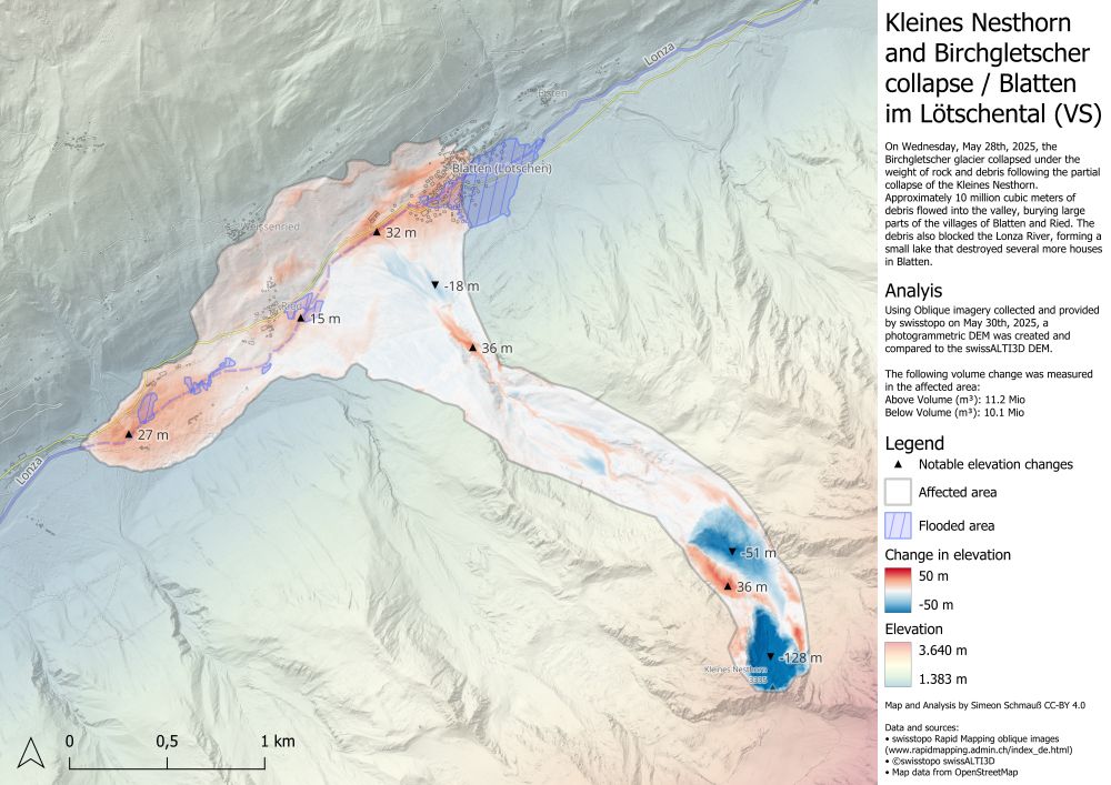
250+ million acres of public lands eligible for sale in SENR bill
The bill mandates disposal of over 2 million acres of BLM and National Forest lands; public lands eligible for sale in the bill encompass over 250 million acres, including local recreation areas, wild...
www.wilderness.org
Reposted by Chris Wilson