George H. Allen
@geoallen.bsky.social
480 followers
210 following
36 posts
Hydrologist and satellite enthusiast. Associate Professor at Virginia Tech
Posts
Media
Videos
Starter Packs


Reposted by George H. Allen


Reposted by George H. Allen


George H. Allen
@geoallen.bsky.social
· Aug 27
Reposted by George H. Allen
George H. Allen
@geoallen.bsky.social
· Jul 13
George H. Allen
@geoallen.bsky.social
· Jul 12

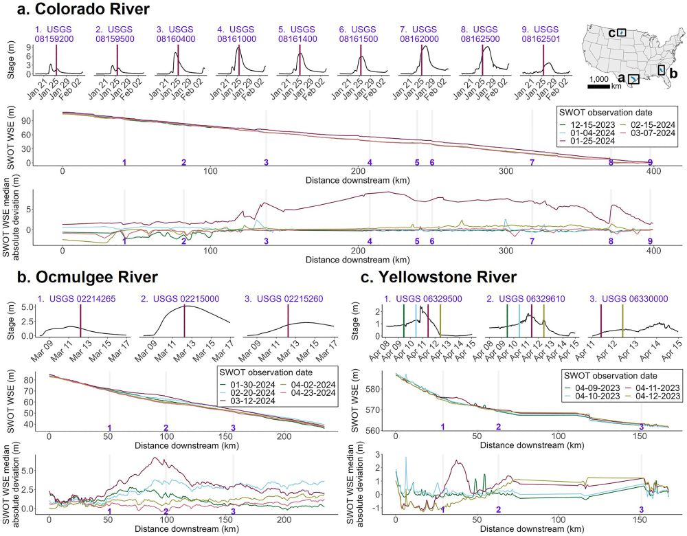
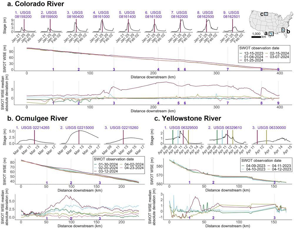
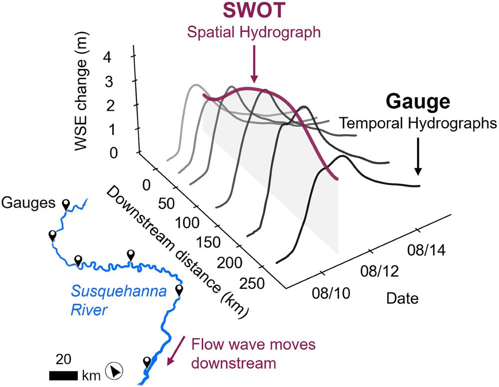
SWOT Captures Hydrologic Waves Traveling Down Rivers
Surface Water and Ocean Topography data show downstream changes in river height during a flow wave hydrologic event
By removing the river's long profile, flow wave events are visualized as hydrog...
agupubs.onlinelibrary.wiley.com
George H. Allen
@geoallen.bsky.social
· Jul 11
Reposted by George H. Allen
Reposted by George H. Allen
George H. Allen
@geoallen.bsky.social
· Jun 25

Reposted by George H. Allen

George H. Allen
@geoallen.bsky.social
· May 20