
Lars Lowinski
@larswx.bsky.social
320 followers
160 following
170 posts
RMetS Chartered Meteorologist, photographer, occasional storm chaser.
Interested in severe weather, natural hazards and risk communication.
Opinions are my own.
My photography: larslowinski.com
Posts
Media
Videos
Starter Packs


Reposted by Lars Lowinski


Reposted by Lars Lowinski


Reposted by Lars Lowinski

Reposted by Lars Lowinski


Reposted by Lars Lowinski


Reposted by Lars Lowinski

Lars Lowinski
@larswx.bsky.social
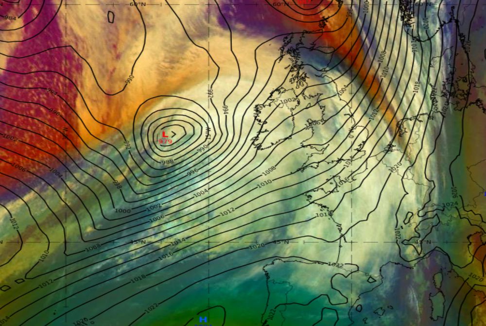
· Sep 8


