Reposted by: Adrian Luckman

Reposted by: Adrian Luckman
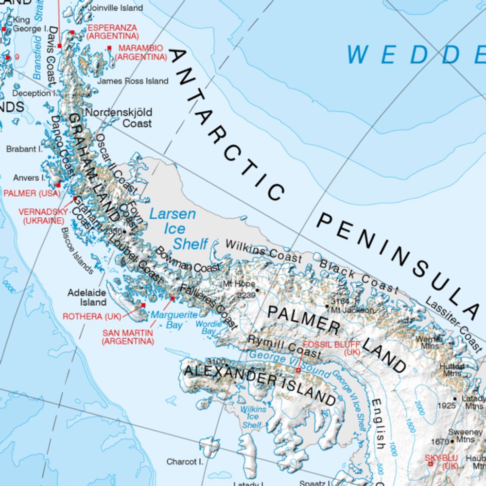
We also compiled a new database of Svalbard's surge-type glaciers: zenodo.org/records/1524...
@dannipearce.bsky.social @hazlovell.bsky.social @adrianluckman.bsky.social
Reposted by: Adrian Luckman, Fabrice Ardhuin

Reposted by: Adrian Luckman

Reposted by: Adrian Luckman
Reposted by: Adrian Luckman

Reposted by: Adrian Luckman

👉Develop and deploy open-source sensors to measure #biophysical properties to predict #coastal #wetland #restoration success @ Swansea Uni + 3-month placement with Welsh Gov. Plz share! 🙏
www.swansea.ac.uk/postgraduate...

Reposted by: Adrian Luckman
Reposted by: Adrian Luckman

Reposted by: Adrian Luckman

Reposted by: Adrian Luckman

Reposted by: Adrian Luckman


Reposted by: Adrian Luckman
Reposted by: Adrian Luckman

Reposted by: Adrian Luckman

Reposted by: Adrian Luckman

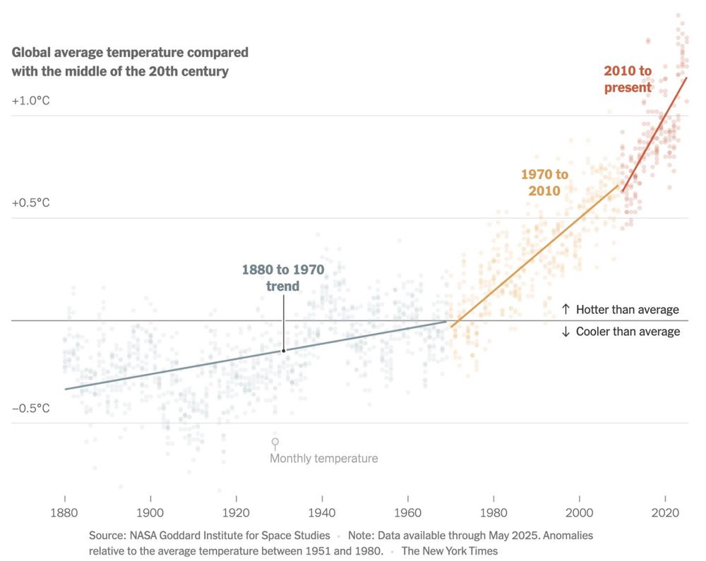
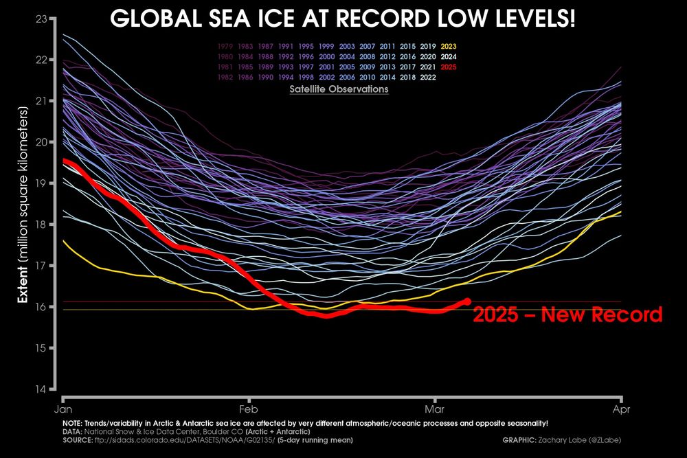
More graphs at zacklabe.com/global-sea-i.... Data from @nsidc.bsky.social.
Reposted by: Adrian Luckman
1/3


Reposted by: Adrian Luckman
The Arctic is becoming totally unrecognisable.
And in the meantime #BP and #Equinor are doubling down on fossil fuels.
Profits over people. Profits over a liveable Earth.
Reposted by: Adrian Luckman
1990 | 2021
Remember the 1990s? ⌚️❄️
Seems so far away from a glaciological point of view! 😱
And the most recent pic here was taken before the recent record-breaking heatwaves which wiped out 10% of Alpine ice in just 2 years! 🔥
📷 Servizio Glaciologico Lombardo