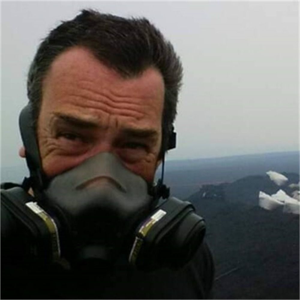
Baptiste Gombert
@baptistegomb.bsky.social
140 followers
140 following
10 posts
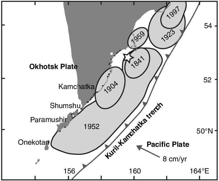
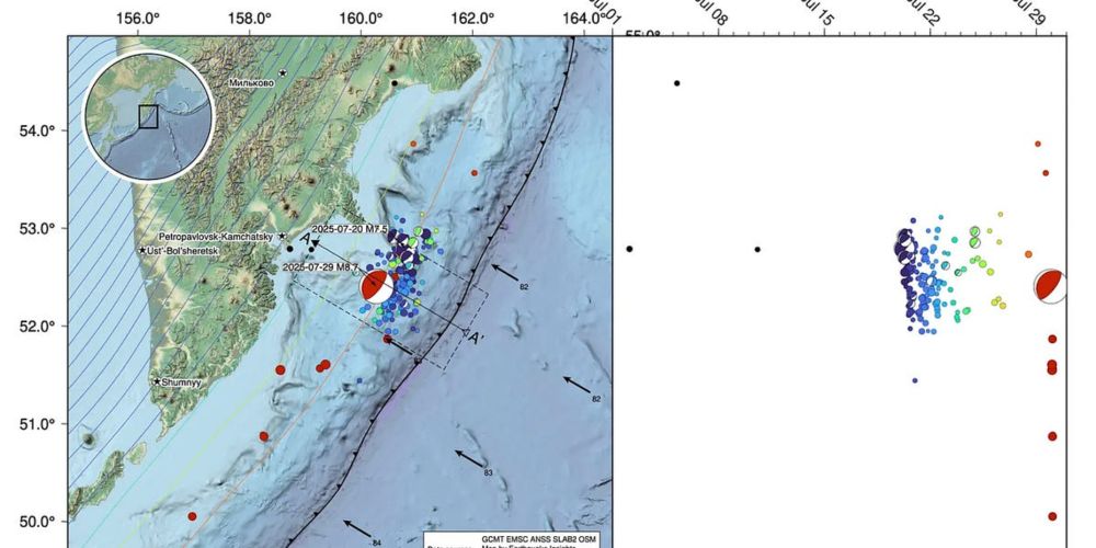
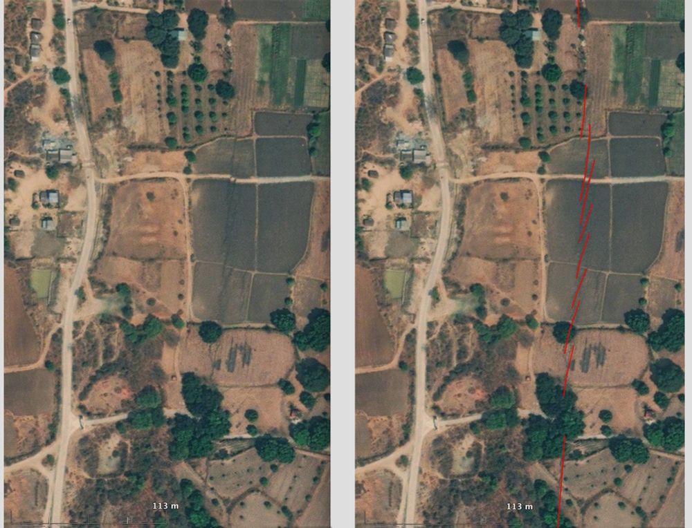
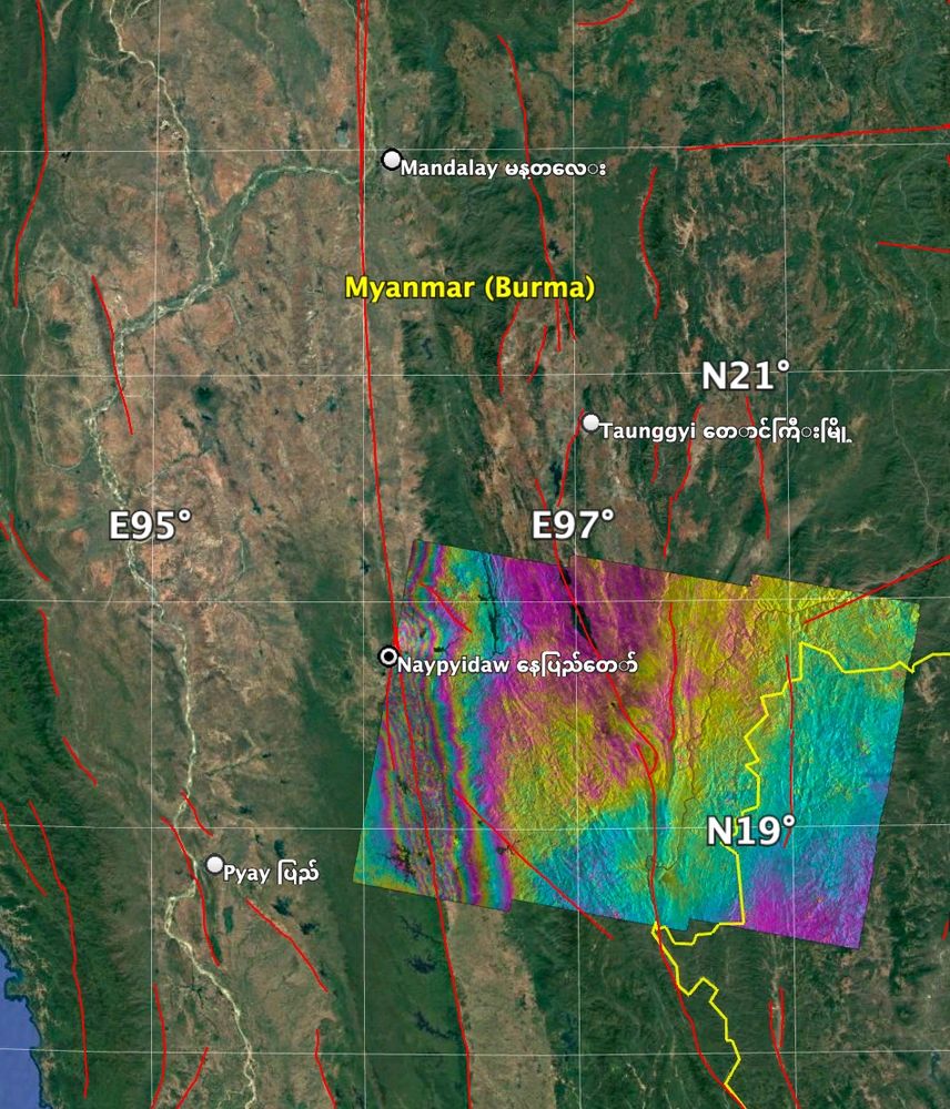
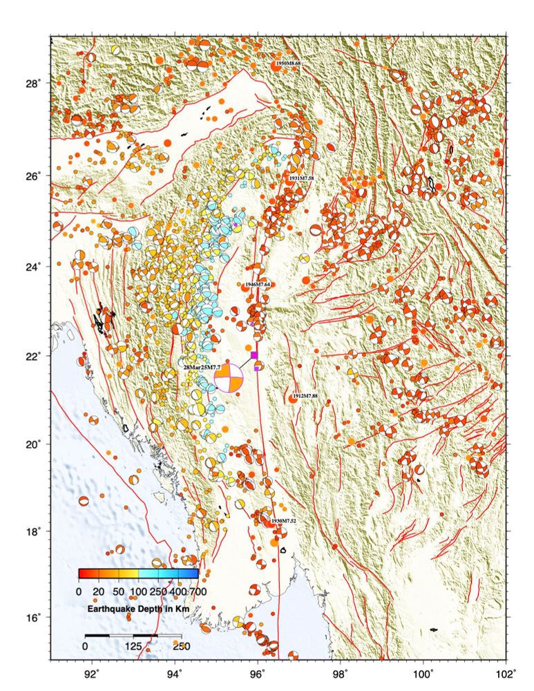
Satellite Hydrology Specialist at CNES🛰️, but also with strong interests in seismology, tectonics, geophysics... and mountaineering!
Posts
Media
Videos
Starter Packs
Pinned

Reposted by Baptiste Gombert


Reposted by Baptiste Gombert
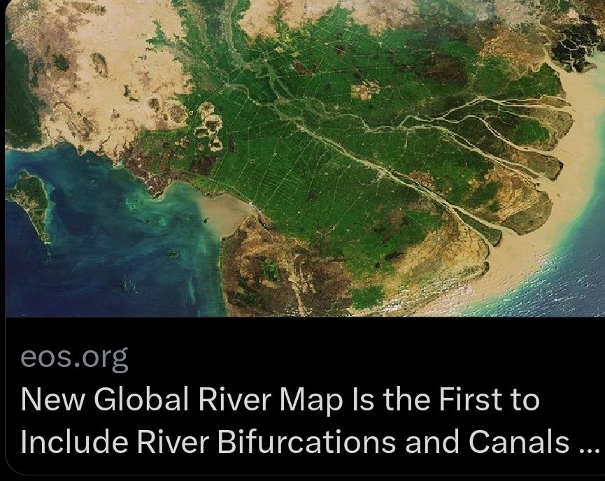
Angel Ruiz-Angulo
@rocangel.bsky.social
· Aug 11
Reposted by Baptiste Gombert
Reposted by Baptiste Gombert

Reposted by Baptiste Gombert


Reposted by Baptiste Gombert
Reposted by Baptiste Gombert


Reposted by Baptiste Gombert

Reposted by Baptiste Gombert
Reposted by Baptiste Gombert


Reposted by Baptiste Gombert


Reposted by Baptiste Gombert


Reposted by Baptiste Gombert

Reposted by Baptiste Gombert

Reposted by Baptiste Gombert


Reposted by Baptiste Gombert
Reposted by Baptiste Gombert

Reposted by Baptiste Gombert

Reposted by Baptiste Gombert