James Dalziel
@j-dalziel.bsky.social
970 followers
130 following
89 posts
Volcanologist, Earth Risk Research Lead at WTW, drummer, medieval re-enactor, music lover, gearhead, pub enthusiast & sci-fi nerd. Posting news & research relating to geological hazards, science, technology & the environment.
Posts
Media
Videos
Starter Packs


Reposted by James Dalziel


Reposted by James Dalziel


Reposted by James Dalziel


James Dalziel
@j-dalziel.bsky.social
· Aug 15
James Dalziel
@j-dalziel.bsky.social
· Aug 15

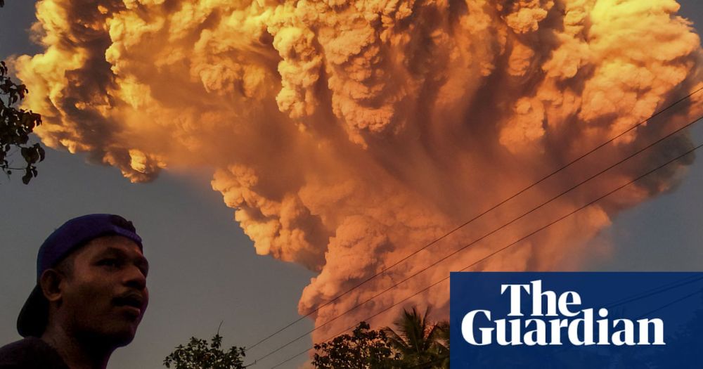
Cities near volcanoes: which cities are most exposed to volcanic hazards?
Abstract. Cities near volcanoes expose dense concentrations of people, buildings, and infrastructure to volcanic hazards. Identifying cities globally that are exposed to volcanic hazards helps guide l...
nhess.copernicus.org
Reposted by James Dalziel
Reposted by James Dalziel

James Dalziel
@j-dalziel.bsky.social
· Jul 3
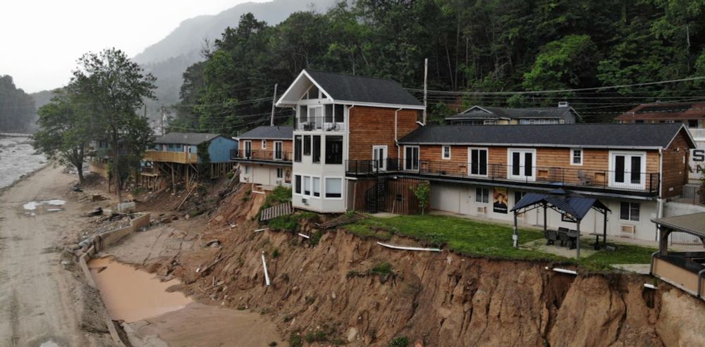
Hurricane Helene set up future disasters, from landslides to flooding – cascading hazards like these are now upending risk models
Risk models can’t rely just on the past anymore. A team of geoscientists suggests new ways to forecast evolving hazards in real time as cascading disaster risk worsens.
theconversation.com
Reposted by James Dalziel
James Dalziel
@j-dalziel.bsky.social
· Jun 19
Reposted by James Dalziel

Reposted by James Dalziel

Reposted by James Dalziel

Reposted by James Dalziel

Reposted by James Dalziel

Reposted by James Dalziel

Reposted by James Dalziel

Reposted by James Dalziel