


Johann Huntera
@chattwjonathan.bsky.social
Meteorologist & car safety systems. husband, father, Chattahooligan. He/him
Retweets are only endorsements if weather. You can like bad weather posts, it doesn't make you a bad person
Retweets are only endorsements if weather. You can like bad weather posts, it doesn't make you a bad person
Reposted by Johann Huntera
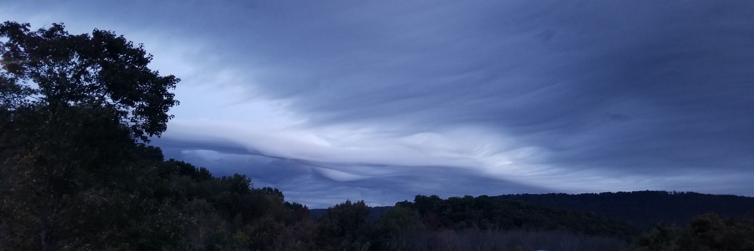
Is something going on this weekend?

January 22, 2026 at 11:25 AM
Is something going on this weekend?
Reposted by Johann Huntera

Good morning! Here are the newest Key Messages posted this morning.

January 22, 2026 at 11:04 AM
Good morning! Here are the newest Key Messages posted this morning.
Reposted by Johann Huntera

Watching 0z GFS roll in. More ice than snow. But, of note, for some, more sleet than FRZ rain perhaps. I'm down for anything verifying that means we don't lose power. FRZ rain totals remain up there. People & clickbaiters rooting for disaster "Charter by the Sea". Not a lock on this. #ncwx #wncwx
January 22, 2026 at 4:15 AM
Reposted by Johann Huntera

The 00Z GFS, which has data from the Hurricane Hunter mission tonight, is more or less the same - decent snowfall for #RVA before changing to mix late Sunday afternoon.
Meanwhile, the 00Z ICON - which is similar to the Euro - still shows a high impact ice storm.
Clear as mud. #vawx
Meanwhile, the 00Z ICON - which is similar to the Euro - still shows a high impact ice storm.
Clear as mud. #vawx


January 22, 2026 at 4:08 AM
Reposted by Johann Huntera
Reposted by Johann Huntera

Nearly everyone east of the Rockies will see impacts from snow, ice, and/or extreme cold beginning by Friday and lasting through early next week. Get prepared ahead of the storm so your weekend plans can be to stay home and stay warm!
weather.gov
weather.gov


January 21, 2026 at 8:50 PM
Nearly everyone east of the Rockies will see impacts from snow, ice, and/or extreme cold beginning by Friday and lasting through early next week. Get prepared ahead of the storm so your weekend plans can be to stay home and stay warm!
weather.gov
weather.gov
Here's a excellent Forecast Discussion from NWS Peachtree City (Atlanta): Forecaster Hernandez.
Good nuance of comparing the ECMWF to the others and urging caution to wait until 00z runs tonight when they will also have added recon data.
Top notch stuff here.
Good nuance of comparing the ECMWF to the others and urging caution to wait until 00z runs tonight when they will also have added recon data.
Top notch stuff here.


January 21, 2026 at 9:11 PM
Here's a excellent Forecast Discussion from NWS Peachtree City (Atlanta): Forecaster Hernandez.
Good nuance of comparing the ECMWF to the others and urging caution to wait until 00z runs tonight when they will also have added recon data.
Top notch stuff here.
Good nuance of comparing the ECMWF to the others and urging caution to wait until 00z runs tonight when they will also have added recon data.
Top notch stuff here.
Anxiously awaiting the afternoon Forecast Discussions from the NWS FOs
January 21, 2026 at 8:36 PM
Anxiously awaiting the afternoon Forecast Discussions from the NWS FOs
I'm going to dare to go to Walmart.
Need some supplies for staffing up this weekend.
Need some supplies for staffing up this weekend.
January 21, 2026 at 7:24 PM
I'm going to dare to go to Walmart.
Need some supplies for staffing up this weekend.
Need some supplies for staffing up this weekend.
Reposted by Johann Huntera

This animation shows how many of the 50 ECMWF ensemble members meet the criteria for a Cold Weather Advisory over the next 14 days. #Jealous
January 21, 2026 at 6:58 PM
This animation shows how many of the 50 ECMWF ensemble members meet the criteria for a Cold Weather Advisory over the next 14 days. #Jealous
Quick 12z model takeaways
1. Morning model trends are looking warmer - trending towards turning over to rain for Chatt
2. Not all of them
Big winners in these runs:
Chattanooga
Knoxville
Atlanta
Columbia SC
Big losers in these runs:
Memphis
Little Rock
Kentucky and Virginia
1. Morning model trends are looking warmer - trending towards turning over to rain for Chatt
2. Not all of them
Big winners in these runs:
Chattanooga
Knoxville
Atlanta
Columbia SC
Big losers in these runs:
Memphis
Little Rock
Kentucky and Virginia
January 21, 2026 at 7:03 PM
Quick 12z model takeaways
1. Morning model trends are looking warmer - trending towards turning over to rain for Chatt
2. Not all of them
Big winners in these runs:
Chattanooga
Knoxville
Atlanta
Columbia SC
Big losers in these runs:
Memphis
Little Rock
Kentucky and Virginia
1. Morning model trends are looking warmer - trending towards turning over to rain for Chatt
2. Not all of them
Big winners in these runs:
Chattanooga
Knoxville
Atlanta
Columbia SC
Big losers in these runs:
Memphis
Little Rock
Kentucky and Virginia
Reposted by Johann Huntera

Models are still struggling with the complex atmospheric flow pattern that will drive major winter weather impacts this weekend. I take a look at the various features and how data loss (AK raobs) and data gain (recon flights) might affect the forecasts. More: tinyurl.com/mrxx6n2y

High impact winter storm still looming, but many uncertainties remain
Model trends over last 24 hours bring areas farther north into play for potential impacts
tinyurl.com
January 21, 2026 at 6:17 PM
Models are still struggling with the complex atmospheric flow pattern that will drive major winter weather impacts this weekend. I take a look at the various features and how data loss (AK raobs) and data gain (recon flights) might affect the forecasts. More: tinyurl.com/mrxx6n2y
I'm getting spammed with "now they're saying its just gonna rain" because everyone is taking the 06z ECMWF as gospel
January 21, 2026 at 4:46 PM
I'm getting spammed with "now they're saying its just gonna rain" because everyone is taking the 06z ECMWF as gospel
Reposted by Johann Huntera

Carbon monoxide deaths spike during power outages.
If you own a portable generator, make sure you have working carbon monoxide alarms. One portable generator can produce as much carbon monoxide as hundreds of cars.
If you own a portable generator, make sure you have working carbon monoxide alarms. One portable generator can produce as much carbon monoxide as hundreds of cars.
The latest on the major winter storm and extreme cold expected later this week.


January 21, 2026 at 4:23 PM
Carbon monoxide deaths spike during power outages.
If you own a portable generator, make sure you have working carbon monoxide alarms. One portable generator can produce as much carbon monoxide as hundreds of cars.
If you own a portable generator, make sure you have working carbon monoxide alarms. One portable generator can produce as much carbon monoxide as hundreds of cars.
In a rephrasing: Kids, this is why we wait for the experts.

GFS vs. Euro overnight. WHO WILL WIN?
Radically different snow maps.
Radically different snow maps.


January 21, 2026 at 4:05 PM
In a rephrasing: Kids, this is why we wait for the experts.
Reposted by Johann Huntera
My morning first-takeaway is higher confidence in freezing rain for Chattanooga. I'm still working through digesting what that will exactly mean.
Not a great update.
Not a great update.

January 21, 2026 at 2:30 PM
My morning first-takeaway is higher confidence in freezing rain for Chattanooga. I'm still working through digesting what that will exactly mean.
Not a great update.
Not a great update.
Reposted by Johann Huntera
A major winter storm and potential ice storm will move through the Eastern U.S. this weekend. Impacts are expected in north Georgia and now is the time to prepare! The forecast isn't as certain for central Georgia, but this is still a situation you should monitor closely. #gawx #Georgia #ice

January 21, 2026 at 12:24 PM
Reposted by Johann Huntera

Reposted by Johann Huntera

This is the chance of "Moderate" impacts this weekend due to the winter weather system... Meaning travel will certainly be impacted along with utilities. #SpectrumNews1 #ncwx

January 21, 2026 at 1:50 PM
This is the chance of "Moderate" impacts this weekend due to the winter weather system... Meaning travel will certainly be impacted along with utilities. #SpectrumNews1 #ncwx
Reposted by Johann Huntera
Absolutely unreal.
January 21, 2026 at 11:05 AM
Absolutely unreal.
Blueaky needs TMZ right now
January 21, 2026 at 5:13 AM
Blueaky needs TMZ right now
Reposted by Johann Huntera

TIMELAPSE: We had another brief flash of aurora just after sunset this Tuesday evening! Here was the long-exposure view from Marblehead Lighthouse, courtesy of our friends at @shoresandislands.bsky.social.
#Ohio #aurora #timelapse
#Ohio #aurora #timelapse

January 21, 2026 at 3:22 AM
TIMELAPSE: We had another brief flash of aurora just after sunset this Tuesday evening! Here was the long-exposure view from Marblehead Lighthouse, courtesy of our friends at @shoresandislands.bsky.social.
#Ohio #aurora #timelapse
#Ohio #aurora #timelapse
Reposted by Johann Huntera
The latest on the major winter storm and extreme cold expected later this week.
January 21, 2026 at 1:57 AM
The latest on the major winter storm and extreme cold expected later this week.
Reposted by Johann Huntera

GoPro timelapse of the northern lights tonight.
January 21, 2026 at 2:46 AM
GoPro timelapse of the northern lights tonight.
Reposted by Johann Huntera

This is the most astonishing graph of what the Trump regime has done to US science. They have destroyed the federal science workforce across the board. The negative impacts on Americans will be felt for generations, and the US might never be the same again.
www.nature.com/immersive/d4...
www.nature.com/immersive/d4...

January 20, 2026 at 10:53 PM
This is the most astonishing graph of what the Trump regime has done to US science. They have destroyed the federal science workforce across the board. The negative impacts on Americans will be felt for generations, and the US might never be the same again.
www.nature.com/immersive/d4...
www.nature.com/immersive/d4...